IMAGES TAKEN NEAR TO
Foley Avenue, WOLVERHAMPTON, WV6 8LX
Introduction
This page details the photographs taken nearby to Foley Avenue, WV6 8LX by members of the Geograph project.
The Geograph project started in 2005 with the aim of publishing, organising and preserving representative images for every square kilometre of Great Britain, Ireland and the Isle of Man.

There are currently over 7.5m images from over14,400 individuals and you can help contribute to the project by visiting https://www.geograph.org.uk
Image Map
Images are licensed for reuse under creativecommons.org/licenses/by-sa/2.0
Notes
- Clicking on the map will re-center to the selected point.
- The higher the marker number, the further away the image location is from the centre of the postcode.
Image Listing (91 Images Found)
Images are licensed for reuse under creativecommons.org/licenses/by-sa/2.0
Image
Details
Distance
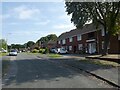
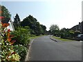
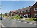
2
Junction of Foley Avenue and Foley Drive
Image: © ElfExplorer
Taken: 2 Aug 2024
0.05 miles
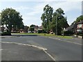
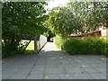
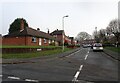
3
Public footpath between Foley Avenue and Woodcote Road
Image: © ElfExplorer
Taken: 2 Aug 2024
0.06 miles
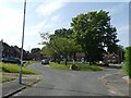
4
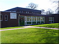
Christ Church Junior School
Christ Church Junior School in Woodcote Road, Tettenhall Wood; the grounds include the school's own copse which children use throughout the year.
Image: © A Holmes
Taken: 3 Apr 2007
0.06 miles
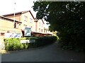
8
Public footpath between Woodcote Road and Foley Avenue
Image: © ElfExplorer
Taken: 2 Aug 2024
0.09 miles
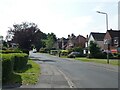
10
Kinfare Drive
The view from Woodhouse Road in Tettenhall Wood.
Image: © Gordon Griffiths
Taken: 23 Nov 2020
0.09 miles