IMAGES TAKEN NEAR TO
The Mews, WOLVERHAMPTON, WV6 8FA
Introduction
This page details the photographs taken nearby to The Mews, WV6 8FA by members of the Geograph project.
The Geograph project started in 2005 with the aim of publishing, organising and preserving representative images for every square kilometre of Great Britain, Ireland and the Isle of Man.

There are currently over 7.5m images from over14,400 individuals and you can help contribute to the project by visiting https://www.geograph.org.uk
Image Map
Images are licensed for reuse under creativecommons.org/licenses/by-sa/2.0
Notes
- Clicking on the map will re-center to the selected point.
- The higher the marker number, the further away the image location is from the centre of the postcode.
Image Listing (97 Images Found)
Images are licensed for reuse under creativecommons.org/licenses/by-sa/2.0
Image
Details
Distance
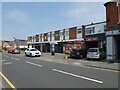
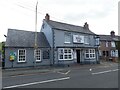
1
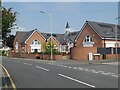
Junction of Tanfield Close and School Road
Image: © ElfExplorer
Taken: 1 Aug 2024
0.03 miles
2
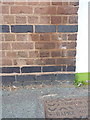
OS benchmark - Tettenhall Wood school
An OS cutmark on the old school building on School Road Image; originally levelled at 138.227m above Ordnance Datum Newlyn.
Image: © Richard Law
Taken: 3 Aug 2015
0.03 miles
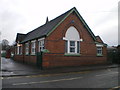
6
Junction of Woodland Avenue and School Road
Image: © ElfExplorer
Taken: 1 Aug 2024
0.04 miles
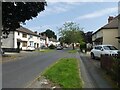
10
Junction of Woodland Avenue and School Road
Image: © ElfExplorer
Taken: 2 Aug 2024
0.05 miles