
IMAGES TAKEN NEAR TO
Rookery Rise, WOLVERHAMPTON, WV5 0NP
Introduction
This page details the photographs taken nearby to Rookery Rise, WV5 0NP by members of the Geograph project.
The Geograph project started in 2005 with the aim of publishing, organising and preserving representative images for every square kilometre of Great Britain, Ireland and the Isle of Man.

There are currently over 7.5m images from over14,400 individuals and you can help contribute to the project by visiting https://www.geograph.org.uk
Image Map
Images are licensed for reuse under creativecommons.org/licenses/by-sa/2.0
Notes
- Clicking on the map will re-center to the selected point.
- The higher the marker number, the further away the image location is from the centre of the postcode.
Image Listing (111 Images Found)
Images are licensed for reuse under creativecommons.org/licenses/by-sa/2.0
Image
Details
Distance
1
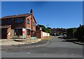
Rookery Rise
The view from Rookery Road in Wombourne.
Image: © Gordon Griffiths
Taken: 29 May 2020
0.04 miles
2
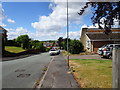
Copper Beech Drive
The view in Wombourne village, Staffordshire.
Image: © Gordon Griffiths
Taken: 5 Jun 2020
0.04 miles
3
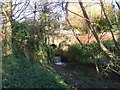
Dam Pool Bridge over the Wom Brook
This bridge carries a footpath over the brook. The pool itself has been filled in.
Image: © John M
Taken: 2 Dec 2006
0.04 miles
4
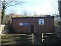
Hallam Hall, Wombourne Girl Guide HQ
The HQ and nursery is in a quiet spot by the Wom Brook.
Image: © John M
Taken: 2 Dec 2006
0.04 miles
5
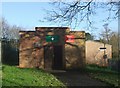
Scout Hut
The 1st Wombourne Scouts share this building with a detachment of the Army Cadet Force. The Girl Guides also have a building nearby Image
Image: © John M
Taken: 2 Dec 2006
0.04 miles
6
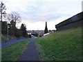
Greenhill View
The view down towards the Wom Brook in Wombourne.
Image: © Gordon Griffiths
Taken: 2 Mar 2020
0.05 miles
7
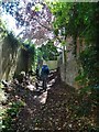
Redcliffe Passage
The view in Wombourne village, Staffordshire.
Image: © Gordon Griffiths
Taken: 5 Jun 2020
0.06 miles
8
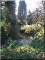
The Wom Brook
The Wom brook rising in the Colton Hills on the edge of Wolverhampton flows across Penn Common to arrive here in Wombourn.
Image: © John M
Taken: 2 Dec 2006
0.07 miles
9
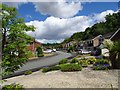
Redcliffe Drive View
The view in Wombourne village, Staffordshire.
Image: © Gordon Griffiths
Taken: 5 Jun 2020
0.07 miles
10

OS benchmark - Wombourne, Gravel Hill bridge parapet over the Wom Brook
An OS cutmark on the stone parapet of Image (facing the onto the road) which was last levelled by the OS in 1962 at 85.8622m above Ordnance Datum Newlyn.
Image: © Richard Law
Taken: 26 Jun 2025
0.08 miles