IMAGES TAKEN NEAR TO
Whites Wood, WOLVERHAMPTON, WV5 0JU
Introduction
This page details the photographs taken nearby to Whites Wood, WV5 0JU by members of the Geograph project.
The Geograph project started in 2005 with the aim of publishing, organising and preserving representative images for every square kilometre of Great Britain, Ireland and the Isle of Man.

There are currently over 7.5m images from over14,400 individuals and you can help contribute to the project by visiting https://www.geograph.org.uk
Image Map
Images are licensed for reuse under creativecommons.org/licenses/by-sa/2.0
Notes
- Clicking on the map will re-center to the selected point.
- The higher the marker number, the further away the image location is from the centre of the postcode.
Image Listing (75 Images Found)
Images are licensed for reuse under creativecommons.org/licenses/by-sa/2.0
Image
Details
Distance
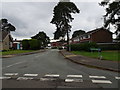
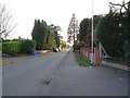
1
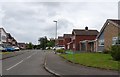
Woodlands Road
The view in Wombourne.
Image: © Gordon Griffiths
Taken: 19 Jun 2020
0.02 miles
2
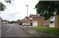
Oaks Drive
The view from Whites Wood in Wombourne.
Image: © Gordon Griffiths
Taken: 19 Jun 2020
0.03 miles
3
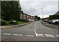
Cedars Avenue
The view from Whites Wood in Wombourne.
Image: © Gordon Griffiths
Taken: 19 Jun 2020
0.05 miles
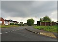
4
Highfields Drive
The view up the close in Wombourne.
Image: © Gordon Griffiths
Taken: 16 Jun 2020
0.06 miles
5
Chestnut Drive
The view in Wombourne.
Image: © Gordon Griffiths
Taken: 19 Jun 2020
0.06 miles
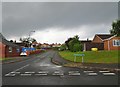
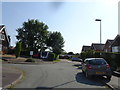
6
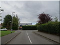
Whites Wood Junction
The view of the junction with Sytch Lane in Wombourne.
Image: © Gordon Griffiths
Taken: 19 Jun 2020
0.06 miles
7
Richmond Gardens
The view near Sytch Lane in Wombourne.
Image: © Gordon Griffiths
Taken: 23 Jun 2020
0.06 miles
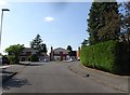
8
Rushford Avenue View
The view of the Broadway in Wombourne.
Image: © Gordon Griffiths
Taken: 16 Jun 2020
0.08 miles
9
Sytch Lane
The view along the Wombourne lane.
Image: © Gordon Griffiths
Taken: 21 Feb 2019
0.08 miles
10
Cedar Avenue
The view in Wombourne.
Image: © Gordon Griffiths
Taken: 23 Jun 2020
0.10 miles