
IMAGES TAKEN NEAR TO
Wolverhampton Road East, WOLVERHAMPTON, WV4 6BB
Introduction
This page details the photographs taken nearby to Wolverhampton Road East, WV4 6BB by members of the Geograph project.
The Geograph project started in 2005 with the aim of publishing, organising and preserving representative images for every square kilometre of Great Britain, Ireland and the Isle of Man.

There are currently over 7.5m images from over14,400 individuals and you can help contribute to the project by visiting https://www.geograph.org.uk
Image Map
Images are licensed for reuse under creativecommons.org/licenses/by-sa/2.0
Notes
- Clicking on the map will re-center to the selected point.
- The higher the marker number, the further away the image location is from the centre of the postcode.
Image Listing (119 Images Found)
Images are licensed for reuse under creativecommons.org/licenses/by-sa/2.0
Image
Details
Distance
1
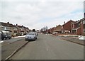
Park Hall Road Scene
The snowy spring view on Goldthorn Park, Wolverhampton.
Image: © Gordon Griffiths
Taken: 28 Mar 2013
0.03 miles

3
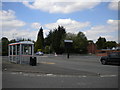
Dudding Road bus turning circle, Goldthorn Park
When the Wolverhampton to Dudley tram route was converted to trolleybus, this turning circle was constructed so that the trolleybuses could turn without occupying the crossroads at Fighting Cocks a short distance to the north. In addition to short workings from Wolverhampton town centre that terminated here, and trolleybuses from Dudley or Sedgley passing through on their way to Wolverhampton, the turning circle was the terminus for trolleybuses from Willenhall via Bilston until 1949, when they were given their own terminus to the west of Fighting Cocks in order to reduce congestion here. Nowadays, the turning circle is merely a large layby as buses have not terminated here for many years (I think I just about remember occasional short workings on the 558 terminating here in the mid 1980s, probably peak extras).
Image: © Richard Vince
Taken: 3 Jun 2013
0.07 miles
5
A459 Bus Stop
The view of the Wolverhampton Road East Bus Stop at the junction with Dudding Road.
Image: © Gordon Griffiths
Taken: 20 Mar 2013
0.07 miles
6
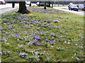
Blakenhall Verge
The verge alongside Wolverhampton Road East.
Image: © Gordon Griffiths
Taken: 21 Mar 2010
0.07 miles
7
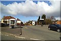
Goldthorn Park Bus Stop
The view of the bus pull in alongside Wolverhampton Road East.
Image: © Gordon Griffiths
Taken: 11 Mar 2013
0.07 miles
8
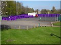
Purple Bins
The view in the former Parkfield High School off Wolverhampton Road East. The new green waste bins costing £35 a year from February 2019.
Image: © Gordon Griffiths
Taken: 10 Apr 2019
0.07 miles
9
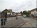
Malins Close View
The view in Parkfield, Wolverhampton.
Image: © Gordon Griffiths
Taken: 27 Jul 2013
0.08 miles
10
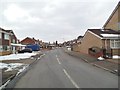
Broadstone Close Junction
The snowy spring view on Goldthorn Park Wolverhampton of the junction with Pencombe Drive.
Image: © Gordon Griffiths
Taken: 28 Mar 2013
0.08 miles