IMAGES TAKEN NEAR TO
Mount Road, WOLVERHAMPTON, WV4 5RS
Introduction
This page details the photographs taken nearby to Mount Road, WV4 5RS by members of the Geograph project.
The Geograph project started in 2005 with the aim of publishing, organising and preserving representative images for every square kilometre of Great Britain, Ireland and the Isle of Man.

There are currently over 7.5m images from over14,400 individuals and you can help contribute to the project by visiting https://www.geograph.org.uk
Image Map
Images are licensed for reuse under creativecommons.org/licenses/by-sa/2.0
Notes
- Clicking on the map will re-center to the selected point.
- The higher the marker number, the further away the image location is from the centre of the postcode.
Image Listing (438 Images Found)
Images are licensed for reuse under creativecommons.org/licenses/by-sa/2.0
Image
Details
Distance
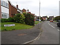
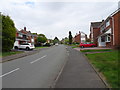
1
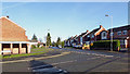
Mount Road in Upper Penn, Wolverhampton
Looking north-east towards the A449 Penn Road by the Mount Tavern public house. Manor Road is a narrow single track lane off to the left, also leading to Penn Road, near the Roebuck public house. ount Road continues off to the left towards its junction with Wakeley Hill - which isn't far from the Barley Mow public house. ;-)
Image: © Roger Kidd
Taken: 20 Jan 2020
0.01 miles
2
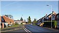
Mount Road in Upper Penn, Wolverhampton
Looking north-east towards the A449 Penn Road by the Mount Tavern public house
Image: © Roger Kidd
Taken: 20 Jan 2020
0.02 miles
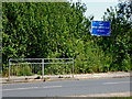
3
Mount Road in Upper Penn, Wolverhampton
Looking north-north-east towards the A449 Penn Road.
Image: © Roger Kidd
Taken: 20 Jan 2020
0.02 miles
4
Hinstock Close
The view from Mount Road on Colton Hills in Penn, Wolverhampton.
Image: © Gordon Griffiths
Taken: 27 Apr 2020
0.03 miles
5
Camberley Drive
The view from Sandhurst Drive in Colton Hills in Penn, Wolverhampton.
Image: © Gordon Griffiths
Taken: 27 Apr 2020
0.03 miles
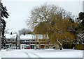
6
Through the hedge to watch the cricket ...
There is a track through hedge to the cricket ground. There has been no play so far this season because of the coronavirus Covid-19 pandemic. In addition, the financial viability of Penn Cricket Club is under severe scrutiny, being down to a single team ready to play when the lockdown is relaxed.
May 2015: Image]
Image: © Roger Kidd
Taken: 23 Jun 2020
0.04 miles
7
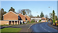
Housing in Hinstock Close, Penn, Wolverhampton
These modern semi-detached modern houses are tucked away in a cul-de-sac off Mount Road. The date of the photograph, March 24 is correct. March 2013 has been the coldest since 1962, daytime maximum temperatures varying from 1°C to 5°C for much of the month. What a contrast with March 2012, when maxima were above 20°C repeatedly on many days.
Image: © Roger D Kidd
Taken: 24 Mar 2013
0.04 miles
8
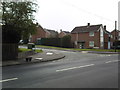
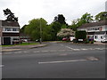
Sandhurst Drive junction with Mount Road, Penn.
Image: © Annette Randle
Taken: 27 Apr 2008
0.04 miles
9
Sandhurst Drive
The view from Mount Road in Colton Hills in Penn, Wolverhampton.
Image: © Gordon Griffiths
Taken: 27 Apr 2020
0.04 miles
10

Recreational area in Penn, Wolverhampton
This small area of land below the cricket field is maintained as a pleasant small grassy recreational facility with one set of football goal posts (with bar). It provides a very handy kick-around space for children or cricket club visitors who find the cricket less than entertaining. Public access is not prevented. The housing is in Mount Road.
Image: © Roger D Kidd
Taken: 12 May 2009
0.04 miles