IMAGES TAKEN NEAR TO
Fareham Crescent, WOLVERHAMPTON, WV4 4YE
Introduction
This page details the photographs taken nearby to Fareham Crescent, WV4 4YE by members of the Geograph project.
The Geograph project started in 2005 with the aim of publishing, organising and preserving representative images for every square kilometre of Great Britain, Ireland and the Isle of Man.

There are currently over 7.5m images from over14,400 individuals and you can help contribute to the project by visiting https://www.geograph.org.uk
Image Map
Images are licensed for reuse under creativecommons.org/licenses/by-sa/2.0
Notes
- Clicking on the map will re-center to the selected point.
- The higher the marker number, the further away the image location is from the centre of the postcode.
Image Listing (44 Images Found)
Images are licensed for reuse under creativecommons.org/licenses/by-sa/2.0
Image
Details
Distance
1
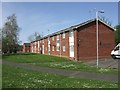
Council Housing - Kingsclere Walk
These houses date from around 1970.
Image: © John M
Taken: 9 Apr 2011
0.09 miles
2
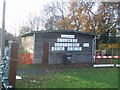
Scout hut and playschool
The 1st Finchfield Scouts share this building in Merry Hill with a playschool.
Image: © John M
Taken: 2 Dec 2006
0.10 miles
3
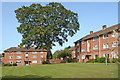
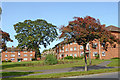
Housing in Warstones, Wolverhampton
These blocks of flats in Warstones Gardens, with their accompanying magnificent tree, are by Warstones Drive, near Merry Hill.
Image: © Roger Kidd
Taken: 17 Sep 2020
0.11 miles
4
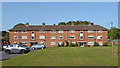
Housing in Warstones Gardens, Wolverhampton
Warstones Gardens is to the north of Warstones Drive near Highfields School.
Image: © Roger Kidd
Taken: 17 Sep 2020
0.11 miles
5
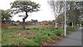
Site of Merry Hill Centre and Merry Hill House
Merry Hill House (a careor nursing home) and Merry Hill Centre (a community centre) stood on this site, but have been demolished in the past year or so.
Image: © Paul Collins
Taken: 21 Oct 2017
0.12 miles
6
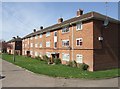
Council Housing - Warstones Gardens
Stylistically these appear to be 1950s though are not shown on my late 1960s streetmap.
Image: © John M
Taken: 9 Apr 2011
0.12 miles
7
Housing in Warstones, Wolverhampton
These blocks of flats in Warstones Gardens, are by Warstones Drive, near Merry Hill.
Image: © Roger Kidd
Taken: 17 Sep 2020
0.13 miles

9
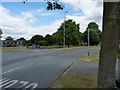
Play area on Warstones Drive
A small play area for children, on the junction of Warstones Drive and Hamble Road.
Image: © Richard Law
Taken: 5 Jul 2010
0.13 miles
10
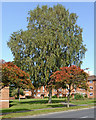
Trees and housing by Warstones Drive in Wolverhampton
Looking north-east towards housing in Warstones Gardens.
Image: © Roger Kidd
Taken: 17 Sep 2020
0.14 miles