1
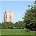
Council Housing - Kingslow Avenue
Image: © John M
Taken: 9 Apr 2011
0.01 miles
2
Council Housing - East Green
The early 1950s saw the postwar development at Warstones. Like other estates of the period there were no boundary walls on the frontage. The photo is taken from the Warstones Green open space.
Image: © John M
Taken: 9 Apr 2011
0.04 miles
3
Park and housing in Warstones, Wolverhampton
Looking east towards East Green and Kingslow Avenue.
Image: © Roger Kidd
Taken: 17 Sep 2020
0.04 miles
4
Warstones Drive near Merry Hill in Wolverhampton
Looking west towards the three Merry Hill tower blocks.
Image: © Roger Kidd
Taken: 17 Sep 2020
0.05 miles
5
Warstones Drive near Merry Hill in Wolverhampton
This is Warstones Drive, looking east towards Warstones Road from near the junction with Leasowes Drive.
Image: © Roger Kidd
Taken: 17 Sep 2020
0.05 miles
6
Warstones Green near Merry Hill in Wolverhampton
Looking north-east towards Warstones Drive and Leasowes Drive. St Joseph's Court (on the left) and Pennwood Court were built 1967-68 by Wimpey, together with Highfields Court, which is off to the left.
Image: © Roger Kidd
Taken: 17 Sep 2020
0.07 miles
7
Housing in Warstones Drive near Merry Hill, Wolverhampton
These are near the junction with Leasowes Drive.
Image: © Roger Kidd
Taken: 17 Sep 2020
0.07 miles
8
Warstones Green near Merry Hill in Wolverhampton
The only equipment on Warstones Green are two rudimentary goal frames and eight recumbent stones. The three tower blocks were built by Wimpey, the project being completed by 1968. From left to right are Highfields Court, St Joseph's Court and Pennwood Court.
Image: © Roger Kidd
Taken: 17 Sep 2020
0.08 miles
9
Park and tower block near Merry Hill in Wolverhampton
Looking north on Warstones Green. Three tower blocks were built by Wimpey, the project being completed by 1968. Pennwood Court is shown in this image. The extensive Warstones Green is an open park which extends behind the camera by about five hundred metres.
Image: © Roger Kidd
Taken: 17 Sep 2020
0.08 miles
10
Not Flying any more...
Times do not look good at the former Flying Dutchman pub on Warstones Drive. The name of the pub may be related to the fact that Dutch soldiers were stationed at Wrottesley Park in the latter years of WW2. Or it may just be in honour of the railway engine.
Image: © Richard Law
Taken: 5 Jul 2010
0.08 miles


