IMAGES TAKEN NEAR TO
Boundary Way, WOLVERHAMPTON, WV4 4NT
Introduction
This page details the photographs taken nearby to Boundary Way, WV4 4NT by members of the Geograph project.
The Geograph project started in 2005 with the aim of publishing, organising and preserving representative images for every square kilometre of Great Britain, Ireland and the Isle of Man.

There are currently over 7.5m images from over14,400 individuals and you can help contribute to the project by visiting https://www.geograph.org.uk
Image Map
Images are licensed for reuse under creativecommons.org/licenses/by-sa/2.0
Notes
- Clicking on the map will re-center to the selected point.
- The higher the marker number, the further away the image location is from the centre of the postcode.
Image Listing (12 Images Found)
Images are licensed for reuse under creativecommons.org/licenses/by-sa/2.0
Image
Details
Distance
1
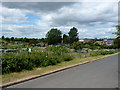
Boundary Road allotments
Council-run allotments on Boundary Road, Warstones. The Highfields Secondary School, now calling itself a Science Specialist School, is in the background.
Image: © Richard Law
Taken: 5 Jul 2010
0.14 miles
2
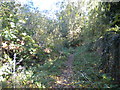
Public footpath west of Warstones
Heading east from Drive Fields.
Image: © Richard Vince
Taken: 20 Oct 2018
0.15 miles
3
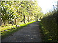
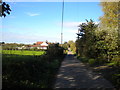
Drive Fields, near Merry Hill (2)
Approaching Hill Croft Farm.
Image: © Richard Vince
Taken: 20 Oct 2018
0.15 miles
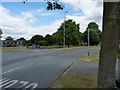
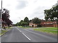
4
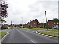
Stourton Drive View
The view from Warstones Drive in Lower Penn, Wolverhampton.
Image: © Gordon Griffiths
Taken: 13 Jul 2019
0.16 miles

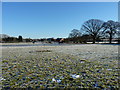
7
Play area on Warstones Drive
A small play area for children, on the junction of Warstones Drive and Hamble Road.
Image: © Richard Law
Taken: 5 Jul 2010
0.17 miles
9
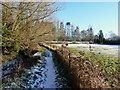
Footpath near Hill Croft Farm
The stream on the left is the Merryhill Brook a tributary of the Smestow Brook
Image: © Richard Law
Taken: 8 Dec 2010
0.20 miles
10
Warstones Drive
The view along Warstones Drive in Lower Penn, Wolverhampton.
Image: © Gordon Griffiths
Taken: 13 Jul 2019
0.22 miles