IMAGES TAKEN NEAR TO
Merridale Road, WOLVERHAMPTON, WV3 9RJ
Introduction
This page details the photographs taken nearby to Merridale Road, WV3 9RJ by members of the Geograph project.
The Geograph project started in 2005 with the aim of publishing, organising and preserving representative images for every square kilometre of Great Britain, Ireland and the Isle of Man.

There are currently over 7.5m images from over14,400 individuals and you can help contribute to the project by visiting https://www.geograph.org.uk
Image Map
Images are licensed for reuse under creativecommons.org/licenses/by-sa/2.0
Notes
- Clicking on the map will re-center to the selected point.
- The higher the marker number, the further away the image location is from the centre of the postcode.
Image Listing (80 Images Found)
Images are licensed for reuse under creativecommons.org/licenses/by-sa/2.0
Image
Details
Distance
1
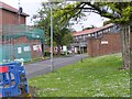
Merridale Court
The view in Merridale, Wolverhampton.
Image: © Gordon Griffiths
Taken: 4 Jun 2017
0.03 miles
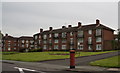
2
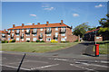
Merridale Court
This is one of several blocks of council flats (many of which are now privately owned) which have become a renowned local feature.
Image: © Bill Boaden
Taken: 22 Jun 2018
0.03 miles
3
Merridale Road
The view in Merridale, Wolverhampton.
Image: © Gordon Griffiths
Taken: 4 Jun 2017
0.03 miles
6
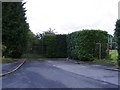
Path and Pitch
The view from Gamefield Gardens in Wolverhampton.
Image: © Gordon Griffiths
Taken: 5 Aug 2017
0.06 miles
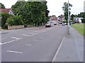
7
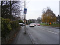
Merridale Road Junction
The view of the junction with Finchfield Road in Wolverhampton.
Image: © Gordon Griffiths
Taken: 10 Dec 2016
0.06 miles
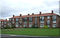
8
Gamesfield Green
The view in Merridale, Wolverhampton.
Image: © Gordon Griffiths
Taken: 4 Jun 2017
0.07 miles
9
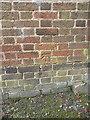
OS benchmark - Merridale, building on Merridale Road
An OS cutmark on the wall of a building (Merridale Court?) at the junction of Bradmore and Merridale Roads; originally levelled at 132.399m above Ordnance Datum Newlyn.
Image: © Richard Law
Taken: 3 Aug 2015
0.07 miles
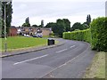
10
Aspen Way
The view in Merridale, Wolverhampton.
Image: © Gordon Griffiths
Taken: 4 Jun 2017
0.08 miles