1
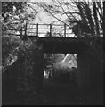
Bridgnorth Road at Compton, Wolverhampton
The minor road off to the right is Alpine Way. Compton Hospice is behind the trees to the left.
Image: © Roger D Kidd
Taken: 11 May 2014
0.04 miles
2
Housing in Alpine Way, Compton, Wolverhampton
Alpine Way is a quiet cul-de-sac on the north side of the A454 Bridgnorth Road.
Image: © Roger D Kidd
Taken: 25 Aug 2017
0.04 miles
3
Housing in Alpine Way, Compton, Wolverhampton
Alpine Way is a quiet cul-de-sac on the north side of the A454 Bridgnorth Road.
It is seen here from the track to the railway walk.
Image: © Roger D Kidd
Taken: 25 Aug 2017
0.04 miles
4
Smestow Valley
The view of the path under the South Staffordshire Railway Walk from Alpine Way Wolverhampton into the Nature Reserve.
Image: © Gordon Griffiths
Taken: 15 May 2015
0.05 miles
5
Bridge Path
The view of the path under the South Staffordshire Railway Walk from Alpine Way Wolverhampton into the Smestow Valley Nature Reserve.
Image: © Gordon Griffiths
Taken: 9 Jan 2023
0.06 miles
6
Old railway overbridge at Compton
The bridge which used to carry the old Great Western line from Oxley Junction to Himley and Brierly Hill. The line was originally intended to go to Bridgnorth, but the First World War got in the way of its construction and by the time work resumed, potential passengers had become used to taking the bus service the GWR had laid on in order to - ironically - get passengers used to the idea of making the journey between Wolverhampton and Bridgnorth. So the destination of the line changed, but the passenger service was never very successful, lasting only seven years until 1932. Freight traffic lasted longer, but the line closed altogether in 1965 and is now a linear walk known as Valley Park.
Image: © John Winder
Taken: 7 Dec 2014
0.06 miles
7
Old Railway Walk, Compton, Wolverhampton
The Wolverhampton to Stourbridge Railway carried passengers for only seven years from 1925 to 1932. Freight transport ceased in 1965.
http://www.wolverhampton.gov.uk/leisure_culture/parks_recreation/countryside/nature_reserves/smestow_valley.htm
http://www.railaroundbirmingham.co.uk/Stations/compton.php Compton Halt.
Image: © Roger D Kidd
Taken: 29 Nov 2007
0.06 miles
8
Access to Nature Reserve in Compton, Wolverhampton
This is the public access point linking Alpine Way with the former railway trackbed. http://www.lnr.naturalengland.org.uk/Special/lnr/lnr_details.asp?C=0&N=&ID=577
Image: © Roger D Kidd
Taken: 25 Aug 2017
0.07 miles
9
Bridgnorth Road in Compton, Wolverhampton
The A454 Bridgnorth Road, looking east towards Wolverhampton city centre, from the former railway bridge.
Image: © Roger D Kidd
Taken: 25 Aug 2017
0.07 miles
10
Bridge View
The view from the disused railway bridge which carries the Valley Park footpath over the Compton Road, Wolverhampton.
Image: © Gordon Griffiths
Taken: 4 Oct 2021
0.08 miles


