IMAGES TAKEN NEAR TO
Denham Gardens, WOLVERHAMPTON, WV3 8LW
Introduction
This page details the photographs taken nearby to Denham Gardens, WV3 8LW by members of the Geograph project.
The Geograph project started in 2005 with the aim of publishing, organising and preserving representative images for every square kilometre of Great Britain, Ireland and the Isle of Man.

There are currently over 7.5m images from over14,400 individuals and you can help contribute to the project by visiting https://www.geograph.org.uk
Image Map
Images are licensed for reuse under creativecommons.org/licenses/by-sa/2.0
Notes
- Clicking on the map will re-center to the selected point.
- The higher the marker number, the further away the image location is from the centre of the postcode.
Image Listing (72 Images Found)
Images are licensed for reuse under creativecommons.org/licenses/by-sa/2.0
Image
Details
Distance

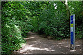
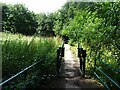
2
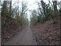
Castlecroft Path
The view of the South Staffordshire Railway Walk at Castlecroft.
Image: © Gordon Griffiths
Taken: 15 Jan 2021
0.07 miles
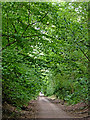
3
Smestow Valley Nature Reserve at Castlecroft, Wolverhampton
Looking north-east towards Compton and Tettenhall.
The Smestow Valley Local Nature Reserve starts here, and continues along the abandoned railway track for two and a half miles (four kilometres). Behind the camera, towards Wombourne, the South Staffordshire Railway Walk continues the facility.
The Great Western Railway opened a branch line from Wolverhampton to Stourbridge (Junction) via Wombourne in 1925. Seven years later it was closed to passengers. The line between Kingswinford and Tettenhall remained open to goods trains until 24 June 1965, though the branch which served Baggeridge Colliery survived until the closure of that facility on 2 March 1968. (from wikipedia)
Image]
Image: © Roger Kidd
Taken: 16 Jul 2020
0.07 miles
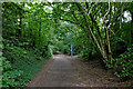
4
Dismantled railway at Castlecroft in Wolverhampton
Looking north-east towards Compton and Tettenhall.
The Smestow Valley Local Nature Reserve starts here, and continues along the abandoned railway track for two and a half miles (four kilometres). Behind the camera, towards Wombourne, the South Staffordshire Railway Walk continues the facility.
The Great Western Railway opened a branch line from Wolverhampton to Stourbridge (Junction) via Wombourne in 1925. Seven years later it was closed to passengers. The line between Kingswinford and Tettenhall remained open to goods trains until 24 June 1965, though the branch which served Baggeridge Colliery survived until the closure of that facility on 2 March 1968. (from wikipedia)
Image]
Image: © Roger Kidd
Taken: 16 Jul 2020
0.08 miles
5
Smestow Valley Nature Reserve at Castlecroft, Wolverhampton
Looking north-east towards Compton and Tettenhall.
The Smestow Valley Local Nature Reserve starts here, and continues along the abandoned railway track for two and a half miles (four kilometres). Behind the camera, towards Wombourne, the South Staffordshire Railway Walk continues the facility.
The Great Western Railway opened a branch line from Wolverhampton to Stourbridge (Junction) via Wombourne in 1925. Seven years later it was closed to passengers. The line between Kingswinford and Tettenhall remained open to goods trains until 24 June 1965, though the branch which served Baggeridge Colliery survived until the closure of that facility on 2 March 1968. (from wikipedia)
Image: © Roger Kidd
Taken: 16 Jul 2020
0.08 miles
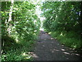
6
Railway walk at Castlecroft in Wolverhampton
Looking north-east towards Compton and Tettenhall.
The Smestow Valley Local Nature Reserve starts here, and continues along the abandoned railway track for two and a half miles (four kilometres). Behind the camera, towards Wombourne, the South Staffordshire Railway Walk continues the facility.
The Great Western Railway opened a branch line from Wolverhampton to Stourbridge (Junction) via Wombourne in 1925. Seven years later it was closed to passengers. The line between Kingswinford and Tettenhall remained open to goods trains until 24 June 1965, though the branch which served Baggeridge Colliery survived until the closure of that facility on 2 March 1968. (from wikipedia)
Image: © Roger Kidd
Taken: 16 Jul 2020
0.09 miles
7
Dismantled railway at Castlecroft in Wolverhampton
Looking north-east towards Compton and Tettenhall. The Smestow Valley Local Nature Reserve starts here, and continues along the abandoned railway track for two and a half miles (four kilometres).
The Great Western Railway opened a branch line from Wolverhampton to Stourbridge (Junction) via Wombourne in 1925. Seven years later it was closed to passengers. The line between Kingswinford and Tettenhall remained open to goods trains until 24 June 1965, though the branch which served Baggeridge Colliery survived until the closure of that facility on 2 March 1968. (from wikipedia)
Image: © Roger Kidd
Taken: 16 Jul 2020
0.09 miles
8
The start of the South Staffs Railway Walk
Looking north-east from the start of the walkway on the old railway line.
Image: © Richard Law
Taken: 6 Jun 2008
0.09 miles
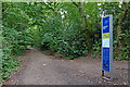
9
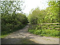
Railway Path Junction
The view from the South Staffordshire Railway Walk at Castlecroft.
Image: © Gordon Griffiths
Taken: 15 May 2015
0.10 miles
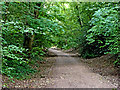
10
Stile View
The view from the South Staffordshire Railway Walk at Castlecroft.
Image: © Gordon Griffiths
Taken: 1 Aug 2022
0.10 miles