IMAGES TAKEN NEAR TO
Bellencroft Gardens, WOLVERHAMPTON, WV3 8DT
Introduction
This page details the photographs taken nearby to Bellencroft Gardens, WV3 8DT by members of the Geograph project.
The Geograph project started in 2005 with the aim of publishing, organising and preserving representative images for every square kilometre of Great Britain, Ireland and the Isle of Man.

There are currently over 7.5m images from over14,400 individuals and you can help contribute to the project by visiting https://www.geograph.org.uk
Image Map
Images are licensed for reuse under creativecommons.org/licenses/by-sa/2.0
Notes
- Clicking on the map will re-center to the selected point.
- The higher the marker number, the further away the image location is from the centre of the postcode.
Image Listing (12 Images Found)
Images are licensed for reuse under creativecommons.org/licenses/by-sa/2.0
Image
Details
Distance

2
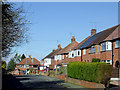
Southfield Grove in Merry Hill, Wolverhampton
This is a pleasant cul-de-sac off Bhylls Lane.
Image: © Roger D Kidd
Taken: 4 Mar 2015
0.14 miles
3
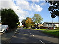
Fareham Crescent View
The view from Langley Road in Merry Hill, Wolverhampton.
Image: © Gordon Griffiths
Taken: 15 Oct 2020
0.15 miles
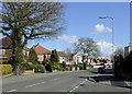
5
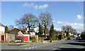
Bhylls Lane in Merry Hill, Wolverhampton
Looking east from the junction with Southfield Grove.
Image: © Roger D Kidd
Taken: 4 Mar 2015
0.17 miles
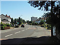
6
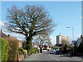
Bhylls Lane in Merry Hill, Wolverhampton
Looking towards the junction with Langley Road. The tower block is St Joseph's Court. There are two more similar blocks nearby to the right.
Image: © Roger D Kidd
Taken: 4 Mar 2015
0.19 miles
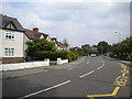
7
Bhylls Lane in Merry Hill, Wolverhampton
Looking towards Merry Hill from the (east) junction with Bellencroft Gardens.
Image: © Roger D Kidd
Taken: 4 Mar 2015
0.21 miles
8
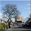
Bhylls Lane in Merry Hill, Wolverhampton
Looking towards the junction with Langley Road. The tower block is St Joseph's Court. There are two more similar blocks nearby to the right.
Image: © Roger D Kidd
Taken: 4 Mar 2015
0.22 miles
9
Bhylls Lane, Finchfield (2)
Approaching Bhylls Acre Primary School (right).
Image: © Richard Vince
Taken: 28 May 2016
0.23 miles
10
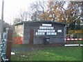
Scout hut and playschool
The 1st Finchfield Scouts share this building in Merry Hill with a playschool.
Image: © John M
Taken: 2 Dec 2006
0.24 miles