IMAGES TAKEN NEAR TO
Finchdene Grove, WOLVERHAMPTON, WV3 8BG
Introduction
This page details the photographs taken nearby to Finchdene Grove, WV3 8BG by members of the Geograph project.
The Geograph project started in 2005 with the aim of publishing, organising and preserving representative images for every square kilometre of Great Britain, Ireland and the Isle of Man.

There are currently over 7.5m images from over14,400 individuals and you can help contribute to the project by visiting https://www.geograph.org.uk
Image Map
Images are licensed for reuse under creativecommons.org/licenses/by-sa/2.0
Notes
- Clicking on the map will re-center to the selected point.
- The higher the marker number, the further away the image location is from the centre of the postcode.
Image Listing (29 Images Found)
Images are licensed for reuse under creativecommons.org/licenses/by-sa/2.0
Image
Details
Distance
1
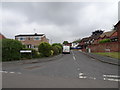
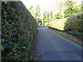
Finchdene Grove
The view in Finchfield, Wolverhampton.
Image: © Gordon Griffiths
Taken: 12 Jun 2020
0.05 miles
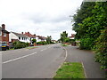
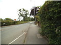
2
York Avenue
The view along the avenue in Finchfield, Wolverhampton.
Image: © Gordon Griffiths
Taken: 3 Feb 2019
0.06 miles
3
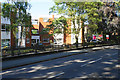
Block of flats on Finchfield Road West
Blocks of private flats often collect lines of sale boards outside.
Image: © Bill Boaden
Taken: 22 Jun 2018
0.09 miles
4
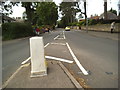
Finchfield Road West
The view near Bantock Park at the junction with Broad Lane, Wolverhampton.
Image: © Gordon Griffiths
Taken: 29 Jun 2013
0.10 miles
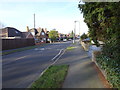
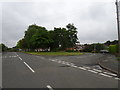
5
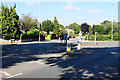
Roundabout on Finchfield Road
Bantock Park begins on the right.
Image: © Bill Boaden
Taken: 22 Jun 2018
0.10 miles
6
Linden Lea Island
The view in Finchfield, Wolverhampton.
Image: © Gordon Griffiths
Taken: 12 Jun 2020
0.11 miles
7
York Avenue
The view along the avenue in Finchfield, Wolverhampton.
Image: © Gordon Griffiths
Taken: 2 Jul 2023
0.11 miles
8
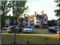
The Spinney
A rather fine example of early 20th century Arts & Crafts design, built in 1907 by the architect William Johnson Harrison Weller, originally as a house for a local man. It has been in use at times as a restaurant and lay empty for much of the 1990s and early 2000s, but is now converted to apartments. Grade II listed https://britishlistedbuildings.co.uk/101262152-the-spinney-tettenhall-wightwick-ward#.Y2mQ43bP3IU & https://historicengland.org.uk/listing/the-list/list-entry/1262152 in 1994.
Image: © Richard Law
Taken: 30 Aug 2022
0.12 miles
9
Finchfield Gardens View
The view along the crescent in Finchfield, Wolverhampton.
Image: © Gordon Griffiths
Taken: 3 Feb 2019
0.13 miles
10
Broad Lane
The view alongside Bantock Park near the junction with Finchfield Road, Wolverhampton.
Image: © Gordon Griffiths
Taken: 29 Jun 2013
0.13 miles