
IMAGES TAKEN NEAR TO
Dalton Street, WOLVERHAMPTON, WV3 0HF
Introduction
This page details the photographs taken nearby to Dalton Street, WV3 0HF by members of the Geograph project.
The Geograph project started in 2005 with the aim of publishing, organising and preserving representative images for every square kilometre of Great Britain, Ireland and the Isle of Man.

There are currently over 7.5m images from over14,400 individuals and you can help contribute to the project by visiting https://www.geograph.org.uk
Image Map
Images are licensed for reuse under creativecommons.org/licenses/by-sa/2.0
Notes
- Clicking on the map will re-center to the selected point.
- The higher the marker number, the further away the image location is from the centre of the postcode.
Image Listing (222 Images Found)
Images are licensed for reuse under creativecommons.org/licenses/by-sa/2.0
Image
Details
Distance
1
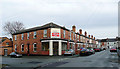
Dalton Street, Penn Fields, Wolverhampton
This shows the junction of Cardiff Street with Dalton Street, and the locally typical late Victorian terrace, slightly "up-market" (they have bay windows) and former corner shop. These solid buildings are being well restored and maintained. Where new roofs have been installed, so has central heating - no chimney stacks remaining. At the end of Dalton Street is Bristol Street. Penn Fields houses a very multi-ethnic community.
Image: © Roger D Kidd
Taken: 8 Dec 2009
0.01 miles
2
Dalton Street
The view in Merridale, Wolverhampton.
Image: © Gordon Griffiths
Taken: 5 May 2018
0.02 miles
3
Bristol Street View
The view in Merridale, Wolverhampton.
Image: © Gordon Griffiths
Taken: 5 May 2018
0.03 miles
4
Bristol Street in Merridale, Wolverhampton
Seen from the junction with Lea Road.
Image: © Roger D Kidd
Taken: 21 Feb 2013
0.04 miles
5
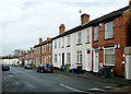
Terraced housing in Cardiff Street, Wolverhampton
These solid late Victorian terraces appear to have been very well renovated and maintained. Note the missing chimney stacks from terraces which have been re-roofed following central heating installation. Lime Street is at the end of Cardiff Street.
Image: © Roger D Kidd
Taken: 8 Dec 2009
0.04 miles
6
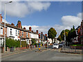
Lea Road near Graiseley in Wolverhampton
Looking north-east towards the A449 Penn Road, and Wolverhampton city centre, from the junction with Oaklands Road.
Image: © Roger Kidd
Taken: 10 Oct 2021
0.04 miles
7
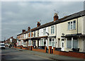
Terraced housing in Penn Fields, Wolverhampton
This is Owen Road between Lea Road and the junction with Dalton Street.
Image: © Roger D Kidd
Taken: 21 Feb 2013
0.04 miles
8
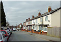
Owen Road in Penn Fields, Wolverhampton
Seen from near the junction with Lea Road.
Image: © Roger D Kidd
Taken: 21 Feb 2013
0.05 miles
9
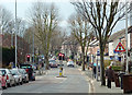
Lea Road in Penn Fields, Wolverhampton
This is a telephoto assisted image looking away from the city, towards the (recently installed) traffic lights where Owen Road leads off to the right, and Oaklands Road goes left to the A449 Penn Road. Clearly, Thursday is "bins" day!
Image: © Roger D Kidd
Taken: 21 Feb 2013
0.05 miles
10
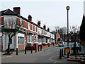
Owen Road, Penn Fields, Wolverhampton
Looking from the crossroads at Burleigh Road towards Lea Road and Oaklands Road. Owen Road and the roads radiating at this junction are now a 20 mph zone with various ridges and bumps on the road surface designed to reduce traffic speed.
Image: © Roger D Kidd
Taken: 17 Mar 2010
0.05 miles