IMAGES TAKEN NEAR TO
George Street, WOLVERHAMPTON, WV2 2LN
Introduction
This page details the photographs taken nearby to George Street, WV2 2LN by members of the Geograph project.
The Geograph project started in 2005 with the aim of publishing, organising and preserving representative images for every square kilometre of Great Britain, Ireland and the Isle of Man.

There are currently over 7.5m images from over14,400 individuals and you can help contribute to the project by visiting https://www.geograph.org.uk
Image Map
Images are licensed for reuse under creativecommons.org/licenses/by-sa/2.0
Notes
- Clicking on the map will re-center to the selected point.
- The higher the marker number, the further away the image location is from the centre of the postcode.
Image Listing (142 Images Found)
Images are licensed for reuse under creativecommons.org/licenses/by-sa/2.0
Image
Details
Distance
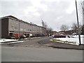
1
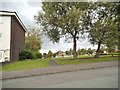
John Street Open Space
The view from John Street, Ettingshall, Bilston.
Image: © Gordon Griffiths
Taken: 12 Aug 2013
0.03 miles
2
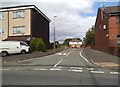
Pump Street
The view from George Street, Wolverhampton.
Image: © Gordon Griffiths
Taken: 8 Sep 2013
0.03 miles
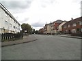
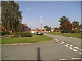
3
Pembroke Avenue
The view in Ettingshall, Bilston.
Image: © Gordon Griffiths
Taken: 20 Aug 2013
0.03 miles
4
John Street
The view down John Street in Ettingshall, Bilston.
Image: © Gordon Griffiths
Taken: 12 Aug 2013
0.03 miles
5
Boydon Close
The view from George Street, Ettingshall, Bilston.
Image: © Gordon Griffiths
Taken: 28 Mar 2013
0.04 miles

7
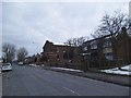
George Street Church
The view alongside the former Methodist Church in Priestfield, Bilston.
Image: © Gordon Griffiths
Taken: 28 Mar 2013
0.06 miles
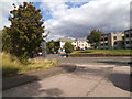
8
Pembroke Avenue Scene
The view in Ettingshall, Bilston.
Image: © Gordon Griffiths
Taken: 24 Sep 2013
0.07 miles
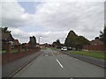
9
George Street Corner
The view from Ettingshall Road, Wolverhampton.
Image: © Gordon Griffiths
Taken: 8 Sep 2013
0.07 miles
10
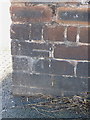
OS benchmark - Priestfield, George Street
An OS cutmark in a brick wall adjacent to the Tabernacle Church in George Street. Originally levelled at 140.348m above Ordnance Datum Newlyn.
Image: © Richard Law
Taken: 6 Oct 2013
0.08 miles