IMAGES TAKEN NEAR TO
Brown Street, WOLVERHAMPTON, WV2 1HR
Introduction
This page details the photographs taken nearby to Brown Street, WV2 1HR by members of the Geograph project.
The Geograph project started in 2005 with the aim of publishing, organising and preserving representative images for every square kilometre of Great Britain, Ireland and the Isle of Man.

There are currently over 7.5m images from over14,400 individuals and you can help contribute to the project by visiting https://www.geograph.org.uk
Image Map
Images are licensed for reuse under creativecommons.org/licenses/by-sa/2.0
Notes
- Clicking on the map will re-center to the selected point.
- The higher the marker number, the further away the image location is from the centre of the postcode.
Image Listing (126 Images Found)
Images are licensed for reuse under creativecommons.org/licenses/by-sa/2.0
Image
Details
Distance
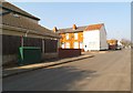
1

Brown Street
The view from Pond Lane Wolverhampton.
Image: © Gordon Griffiths
Taken: 30 Aug 2011
0.02 miles
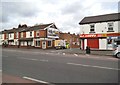
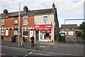
2
Pond lane
The view of the junction with Brown Street in Wolverhampton.
Image: © Gordon Griffiths
Taken: 5 Mar 2013
0.04 miles
3
Brown Street
The view across the A4123 Birmingham Road in Wolverhampton.
Image: © Gordon Griffiths
Taken: 14 Mar 2013
0.05 miles
5
Derry Street
The view from Pond Lane Wolverhampton.
Image: © Gordon Griffiths
Taken: 30 Aug 2011
0.06 miles
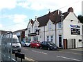
6
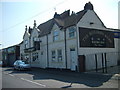
The Builders Arms
The Banks Pub stands in Derry Street.
Image: © Gordon Griffiths
Taken: 28 Jul 2008
0.06 miles
8
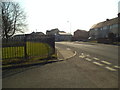
Lilleshall Crescent Junction
The view of the junction with Pond Lane in Wolverhampton.
Image: © Gordon Griffiths
Taken: 5 Mar 2013
0.07 miles
9
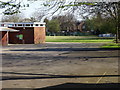
School Grounds
The view of the field behind the St Mary and St John's school off Caledonia Road in Wolverhampton.
Image: © Gordon Griffiths
Taken: 10 Apr 2019
0.07 miles
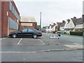
10
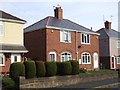
Council Housing - Caledonia Road
Houses on the Green Lane Estate dating from the early 1920s.
Image: © John M
Taken: 30 Oct 2010
0.07 miles