IMAGES TAKEN NEAR TO
Chetton, BRIDGNORTH, WV16 6UE
Introduction
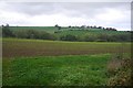
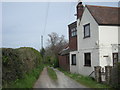
This page details the photographs taken nearby to WV16 6UE by members of the Geograph project.
The Geograph project started in 2005 with the aim of publishing, organising and preserving representative images for every square kilometre of Great Britain, Ireland and the Isle of Man.

There are currently over 7.5m images from over14,400 individuals and you can help contribute to the project by visiting https://www.geograph.org.uk
Image Map
Images are licensed for reuse under creativecommons.org/licenses/by-sa/2.0
Notes
- Clicking on the map will re-center to the selected point.
- The higher the marker number, the further away the image location is from the centre of the postcode.
Image Listing (3 Images Found)
Images are licensed for reuse under creativecommons.org/licenses/by-sa/2.0
Image
Details
Distance
3
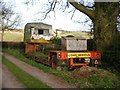
A very strange mating ritual
Quite what were they hoping to make here? A long caravan, maybe? They've been at it quite a while, judging by the amount of moss growing on the participants...
Image: © Richard Law
Taken: 14 Mar 2009
0.13 miles