IMAGES TAKEN NEAR TO
Burwarton, BRIDGNORTH, WV16 6RT
Introduction
This page details the photographs taken nearby to WV16 6RT by members of the Geograph project.
The Geograph project started in 2005 with the aim of publishing, organising and preserving representative images for every square kilometre of Great Britain, Ireland and the Isle of Man.

There are currently over 7.5m images from over14,400 individuals and you can help contribute to the project by visiting https://www.geograph.org.uk
Image Map
Images are licensed for reuse under creativecommons.org/licenses/by-sa/2.0
Notes
- Clicking on the map will re-center to the selected point.
- The higher the marker number, the further away the image location is from the centre of the postcode.
Image Listing (10 Images Found)
Images are licensed for reuse under creativecommons.org/licenses/by-sa/2.0
Image
Details
Distance
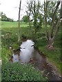
6
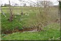
Rea Brook
Soon grows to be a substantial tributary of the Teme.
Image: © Richard Webb
Taken: 14 Apr 2017
0.19 miles
7
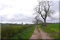
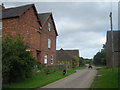
Farm road, Walkerslow
The route can be traced as an enclosed road someway to the north, on to Neenton Heath.
Image: © Richard Webb
Taken: 14 Apr 2017
0.21 miles
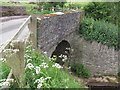
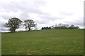
8
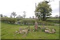
Ruin, The Plackett
A 1949 map shows a house and buildings on this site.
Image: © Richard Webb
Taken: 14 Apr 2017
0.21 miles
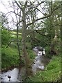
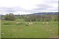
10
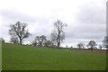
Field, The Plackett
Oaks show the site of a lost hedgerow.
Image: © Richard Webb
Taken: 14 Apr 2017
0.24 miles