
IMAGES TAKEN NEAR TO
Sutton, BRIDGNORTH, WV16 6BQ
Introduction
This page details the photographs taken nearby to Sutton, WV16 6BQ by members of the Geograph project.
The Geograph project started in 2005 with the aim of publishing, organising and preserving representative images for every square kilometre of Great Britain, Ireland and the Isle of Man.

There are currently over 7.5m images from over14,400 individuals and you can help contribute to the project by visiting https://www.geograph.org.uk
Image Map
Images are licensed for reuse under creativecommons.org/licenses/by-sa/2.0
Notes
- Clicking on the map will re-center to the selected point.
- The higher the marker number, the further away the image location is from the centre of the postcode.
Image Listing (19 Images Found)
Images are licensed for reuse under creativecommons.org/licenses/by-sa/2.0
Image
Details
Distance
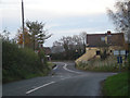
2
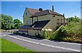
The Kings Arms (closed) (1)
There seems to have been a roadside pub or inn of some sort on this site since possibly the 17th century, and the timber-framed core of that building is within the present much extended building. The pub has been closed since at least 2007, and needless to say has been visited by thieves and vandals since then. It seems extremely unlikely to ever re-open as a pub. There is a very small population around here, and more than sufficient pubs in Highley, Chelmarsh, Billingsley and elsewhere.
Other photos relating to this pub:-
Image
Image
Image
Image
Image
Image: © P L Chadwick
Taken: 21 Jun 2010
0.02 miles
3
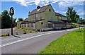
The Kings Arms (closed) (2)
There have been proposals for the conversion of this long-closed pub into residential units, but nothing visible has happened. One wonders whether living in part of a building like this, in such a thinly populated area, would have much appeal. In 2007 the former local authority for this area commissioned various reports, which concluded it had no financial viability either as a pub, as holiday lets or conversion into any other kind of business use.
For more about the pub and links to further photos, please see Image
Image: © P L Chadwick
Taken: 21 Jun 2010
0.02 miles
4
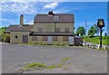
The Kings Arms (closed) (3)
Viewed from its car park. The pub's future is uncertain. It seems its only hope is as residential units. If further time drags on, the building will end up deteriorating further and then its fate could be demolition.
For more about the pub and links to further photos, please see Image
Image: © P L Chadwick
Taken: 21 Jun 2010
0.02 miles
5
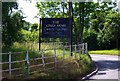
The Kings Arms (closed) (4) - the notice board
Adding a poignant note is the notice board advertising a charity fun night of several years ago. For the other side of the board:- Image
For more about the pub and links to further photos, please see Image
Image: © P L Chadwick
Taken: 21 Jun 2010
0.02 miles
6
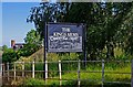
The Kings Arms (closed) (5) - the notice board
Probably the last event ever held at this closed pub was the Charity Fun Night on Saturday the 16th of something. For the other side of the board see:- Image
For more about the pub and links to further photos, please see Image
Image: © P L Chadwick
Taken: 21 Jun 2010
0.02 miles
7
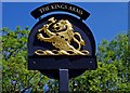
The Kings Arms (closed) (6) - the pub sign
The sign is on a post in the pub's car park. It is a sign typical of those used by the former Banks's Brewery, but the brewery name, which would have been under the lion, has been removed. The other side of the sign is identical, and again the brewery name has been removed. Here is how a Banks's sign looks (for an open pub):- Image
For more about the pub and links to further photos, please see:- Image
Image: © P L Chadwick
Taken: 21 Jun 2010
0.02 miles
8
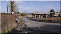
New houses on the King's Arms site, Sutton
There was a pub here, the King's Arms Image The site is now being turned into a residential area.
Just south of Chelmarsh.
Image: © Richard Webb
Taken: 15 Feb 2018
0.03 miles
9
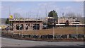
The site of the King's Arms, Sutton
This pub Image is being replaced by houses after a long period of closure.
Image: © Richard Webb
Taken: 15 Feb 2018
0.04 miles
10

Old Direction Sign - Signpost by the B4555, Ingram Lane, Chelmarsh parish
Fan finial - 2 arms; by the B4555, in parish of Chelmarsh (Bridgnorth District), T-junction of the B4555 with Covert Lane, in hedge.
Surveyed
Milestone Society National ID: SA_SO7286
Image: © Milestone Society
Taken: Unknown
0.05 miles