IMAGES TAKEN NEAR TO
Newbolt Road, WV14 7FA
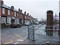
Introduction
This page details the photographs taken nearby to Newbolt Road, WV14 7FA by members of the Geograph project.
The Geograph project started in 2005 with the aim of publishing, organising and preserving representative images for every square kilometre of Great Britain, Ireland and the Isle of Man.

There are currently over 7.5m images from over14,400 individuals and you can help contribute to the project by visiting https://www.geograph.org.uk
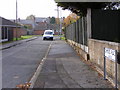
Image Map
Images are licensed for reuse under creativecommons.org/licenses/by-sa/2.0
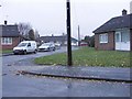
Notes
- Clicking on the map will re-center to the selected point.
- The higher the marker number, the further away the image location is from the centre of the postcode.
Image Listing (188 Images Found)
Images are licensed for reuse under creativecommons.org/licenses/by-sa/2.0
Image
Details
Distance
1
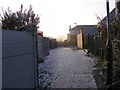
Icy Alley
A cold Alley off Beckett Street, Bilston.
Image: © Gordon Griffiths
Taken: 6 Dec 2010
0.03 miles
2
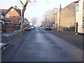
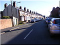
Icy Beckett Street
A cold December day in Bilston.
Image: © Gordon Griffiths
Taken: 6 Dec 2010
0.03 miles
3
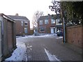
Tryon Place
An icy Close off Beckett Street, Bilston.
Image: © Gordon Griffiths
Taken: 6 Dec 2010
0.04 miles
4
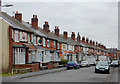
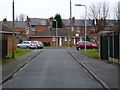
Housing in Ashley Street, Bilston, Wolverhampton
This is the north-east side of the street.
Image: © Roger D Kidd
Taken: 14 Feb 2012
0.07 miles
5
Bevan Close
A Close off Beckett Street on the Lunt Estate, Bilston.
Image: © Gordon Griffiths
Taken: 8 Nov 2010
0.07 miles
6
Ashley Street Junction
The junction with Fraser Street, Bilston
Image: © Gordon Griffiths
Taken: 8 Nov 2010
0.07 miles
7
Ormond Place
The view off Beckett Street on the Lunt Estate, Bilston.
Image: © Gordon Griffiths
Taken: 1 Nov 2010
0.08 miles
8
Ormond Place, Bilston
Infill development of bungalows off Beckett Street. This close is surrounded by terraced housing from around 1900.
Image: © Alan Murray-Rust
Taken: 14 Feb 2012
0.08 miles
9
Ashley Street
A Street off Mount Pleasant, Bilston.
Image: © Gordon Griffiths
Taken: 10 Nov 2010
0.09 miles
10
Holy Trinity Playground
The view of the former Etheridge School site now the Holy Trinity Catholic Primary School.
Image: © Gordon Griffiths
Taken: 14 Nov 2010
0.09 miles