IMAGES TAKEN NEAR TO
Nightingale Place, BILSTON, WV14 6LZ
Introduction
This page details the photographs taken nearby to Nightingale Place, WV14 6LZ by members of the Geograph project.
The Geograph project started in 2005 with the aim of publishing, organising and preserving representative images for every square kilometre of Great Britain, Ireland and the Isle of Man.

There are currently over 7.5m images from over14,400 individuals and you can help contribute to the project by visiting https://www.geograph.org.uk
Image Map
Images are licensed for reuse under creativecommons.org/licenses/by-sa/2.0
Notes
- Clicking on the map will re-center to the selected point.
- The higher the marker number, the further away the image location is from the centre of the postcode.
Image Listing (255 Images Found)
Images are licensed for reuse under creativecommons.org/licenses/by-sa/2.0
Image
Details
Distance
1
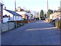
Nightingale Place View
The Bilston close off Mountford Lane.
Image: © Gordon Griffiths
Taken: 3 Feb 2012
0.02 miles
3
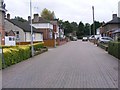
Nightingale Place
A Cul-de-sac off Mountford Lane.
Image: © Gordon Griffiths
Taken: 30 Sep 2008
0.03 miles
4
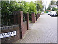
Alexandra Place
A Cul-de-sac off Mountford Lane.
Image: © Gordon Griffiths
Taken: 30 Sep 2008
0.03 miles
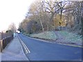
5
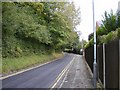
Mountford Lane
The Lane runs alongside Peascroft Wood.
Image: © Gordon Griffiths
Taken: 30 Sep 2008
0.05 miles
6
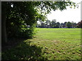
Proud's Lane Field
The view of the playing field in Bilston.
Image: © Gordon Griffiths
Taken: 22 Sep 2020
0.05 miles
7

Bilston Snowman
The view of Proud's lane Playing Fields.
Image: © Gordon Griffiths
Taken: 12 Dec 2022
0.05 miles
8
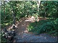
Peascroft Glade
The view in Peascroft Wood off Mountford Lane in Bilston.
Image: © Gordon Griffiths
Taken: 22 Sep 2020
0.06 miles
9
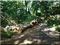
Peascroft Wood
The view in Bilston.
Image: © Gordon Griffiths
Taken: 9 Aug 2024
0.06 miles
10
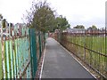
Nightingale Passage
The Passage crosses Proud's Lane Playing Fields.
Image: © Gordon Griffiths
Taken: 30 Sep 2008
0.06 miles