IMAGES TAKEN NEAR TO
Babbington Drive, BILSTON, WV14 0SW
Introduction
This page details the photographs taken nearby to Babbington Drive, WV14 0SW by members of the Geograph project.
The Geograph project started in 2005 with the aim of publishing, organising and preserving representative images for every square kilometre of Great Britain, Ireland and the Isle of Man.

There are currently over 7.5m images from over14,400 individuals and you can help contribute to the project by visiting https://www.geograph.org.uk
Image Map
Images are licensed for reuse under creativecommons.org/licenses/by-sa/2.0
Notes
- Clicking on the map will re-center to the selected point.
- The higher the marker number, the further away the image location is from the centre of the postcode.
Image Listing (133 Images Found)
Images are licensed for reuse under creativecommons.org/licenses/by-sa/2.0
Image
Details
Distance
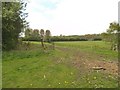
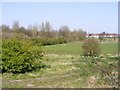
1
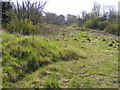
Bilston Field
The view of wasteland off Coseley Road, Bilston.
Image: © Gordon Griffiths
Taken: 18 Apr 2010
0.02 miles
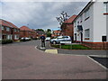
2
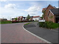
Babbington Drive
The view on Bilston's New Urban Village.
Image: © Gordon Griffiths
Taken: 5 May 2022
0.02 miles
3
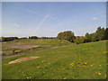
Wasteland View
The view of the wasteland in Bilston alongside Coseley Road.
Image: © Gordon Griffiths
Taken: 3 May 2014
0.03 miles
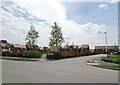
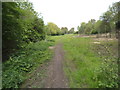
4
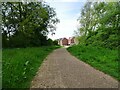
Park Path
The view of the path on Bilston's New Urban Village.
Image: © Gordon Griffiths
Taken: 5 May 2022
0.05 miles
5
Cardowen Place View
The view along Montagu Drive on Bilston's New Urban Village.
Image: © Gordon Griffiths
Taken: 1 Jun 2022
0.06 miles
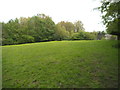
6
Sports Field Border
The view over the school field of the now demolished Bilston High, in the past it was named Hall Green and before that in the fifties was Stonefield Secondary Modern. The field is now part of the Bilston Academy in Dudley Street.
Image: © Gordon Griffiths
Taken: 29 Apr 2014
0.06 miles
7
Ambergate Road
The view on Bilston's New Urban Village.
Image: © Gordon Griffiths
Taken: 5 May 2022
0.06 miles
8
Dudley Road Field
The view of the field in woodland in Bilston alongside Dudley Road.
Image: © Gordon Griffiths
Taken: 29 Apr 2014
0.06 miles
9
School Field view
The view of school field of the now demolished Bilston High, in the past it was named Hall Green and before that in the fifties was Stonefield Secondary Modern.
Image: © Gordon Griffiths
Taken: 18 Apr 2010
0.06 miles
10
Dudley Road Path
The view of the woodland path in Bilston alongside Dudley Road.
Image: © Gordon Griffiths
Taken: 29 Apr 2014
0.07 miles