IMAGES TAKEN NEAR TO
Verwood Close, WILLENHALL, WV13 3QQ
Introduction
This page details the photographs taken nearby to Verwood Close, WV13 3QQ by members of the Geograph project.
The Geograph project started in 2005 with the aim of publishing, organising and preserving representative images for every square kilometre of Great Britain, Ireland and the Isle of Man.

There are currently over 7.5m images from over14,400 individuals and you can help contribute to the project by visiting https://www.geograph.org.uk
Image Map
Images are licensed for reuse under creativecommons.org/licenses/by-sa/2.0
Notes
- Clicking on the map will re-center to the selected point.
- The higher the marker number, the further away the image location is from the centre of the postcode.
Image Listing (41 Images Found)
Images are licensed for reuse under creativecommons.org/licenses/by-sa/2.0
Image
Details
Distance
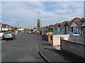
1
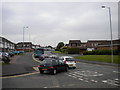
Evening peak traffic, Moseley Road, Portobello
At around half past five on a Wednesday afternoon, traffic queues along Moseley Road from its junction with the A454 Willenhall Road.
Image: © Richard Vince
Taken: 5 Jun 2013
0.07 miles
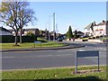
2
Alcester Drive, Portobello
A residential cul de sac off Moseley Road, close to the north eastern corner of Stowlawn estate (some of whose flats are visible on the left; see Image).
Image: © Richard Vince
Taken: 5 Jun 2013
0.10 miles
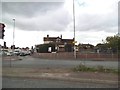
3
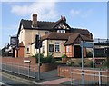
The Neachells Public House
Pub next to a busy junction on the Wolverhampton to Willenhall and Walsall road.
Image: © John M
Taken: 23 Sep 2006
0.10 miles
4
Moseley Road Lights
The crossing near to Stowlawn Estate, Bilston.
Image: © Gordon Griffiths
Taken: 20 Oct 2010
0.11 miles
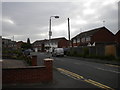
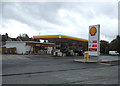
5
The Neachells
The view of the former Pub on Neachells Lane, Wolverhampton. The Pub in 2006.Image
Image: © Gordon Griffiths
Taken: 6 May 2014
0.15 miles
8

Lawnside Green Walk
The passage from the Green onto Prouds Lane, Bilston.
Image: © Gordon Griffiths
Taken: 20 Oct 2010
0.18 miles
9
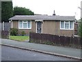
Council Housing - Hill Road
Immediately after the Second World War prefabricated concrete bungalows were offered to local authorities in an attempt to meet a housing shortage. This small estate was built in Bilston in Arnhem Road and Alamein Road, Portobello. The houses had an intended life of ten years.
Image: © John M
Taken: 21 Nov 2010
0.18 miles
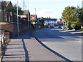
10
Prouds Lane End
The point where the Lane meets Moseley Road, Bilston.
Image: © Gordon Griffiths
Taken: 20 Oct 2010
0.19 miles