IMAGES TAKEN NEAR TO
Shepherd Drive, WILLENHALL, WV12 4JB
Introduction
This page details the photographs taken nearby to Shepherd Drive, WV12 4JB by members of the Geograph project.
The Geograph project started in 2005 with the aim of publishing, organising and preserving representative images for every square kilometre of Great Britain, Ireland and the Isle of Man.

There are currently over 7.5m images from over14,400 individuals and you can help contribute to the project by visiting https://www.geograph.org.uk
Image Map
Images are licensed for reuse under creativecommons.org/licenses/by-sa/2.0
Notes
- Clicking on the map will re-center to the selected point.
- The higher the marker number, the further away the image location is from the centre of the postcode.
Image Listing (24 Images Found)
Images are licensed for reuse under creativecommons.org/licenses/by-sa/2.0
Image
Details
Distance
1
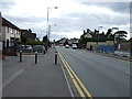
Lucknow Road
Junction with Pool Hayes Road. The advert for pies refers to the shops across a small green on the left. Image
Image: © Richard Webb
Taken: 13 Apr 2016
0.12 miles
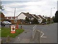
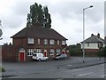
2
Shops, Lucknow Road
Post war housing development, Willenhall.
Image: © Richard Webb
Taken: 13 Apr 2016
0.15 miles
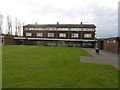
4
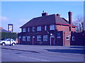
The Jolly Collier
The Pub stands in Lucknow Road.
Image: © Gordon Griffiths
Taken: 5 Mar 2009
0.17 miles
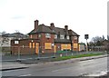
5
The former Brown Jug (2) - sign, 52 Sandbeds Road, Shortheath, Willenhall
The sign of this closed pub is still present, on top of a post in the front car park, adjacent to Sandbeds Road.
Image
Image: © P L Chadwick
Taken: 29 Dec 2011
0.17 miles
6
The former Brown Jug (1), 52 Sandbeds Road, Shortheath, Willenhall
The Brown Jug pub has closed and is boarded up. I have no information on the future of the building.
Image
Image: © P L Chadwick
Taken: 29 Dec 2011
0.18 miles
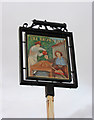
7
Jolly Collier
The Jolly Collier is next to the Wyrley and Essington Canal. The area is now residential but would have been in the local coalfield.
Image: © John M
Taken: 24 Jun 2007
0.20 miles
8
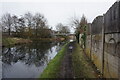
Wyrley & Essington Canal towards Lane Head Bridge
Image: © Ian S
Taken: 16 Dec 2021
0.21 miles
9
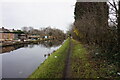
Wyrley & Essington Canal towards Lane Head Bridge
Image: © Ian S
Taken: 16 Dec 2021
0.21 miles