
IMAGES TAKEN NEAR TO
Furzebank Way, WILLENHALL, WV12 4BU
Introduction
This page details the photographs taken nearby to Furzebank Way, WV12 4BU by members of the Geograph project.
The Geograph project started in 2005 with the aim of publishing, organising and preserving representative images for every square kilometre of Great Britain, Ireland and the Isle of Man.

There are currently over 7.5m images from over14,400 individuals and you can help contribute to the project by visiting https://www.geograph.org.uk
Image Map
Images are licensed for reuse under creativecommons.org/licenses/by-sa/2.0
Notes
- Clicking on the map will re-center to the selected point.
- The higher the marker number, the further away the image location is from the centre of the postcode.
Image Listing (5 Images Found)
Images are licensed for reuse under creativecommons.org/licenses/by-sa/2.0
Image
Details
Distance
1
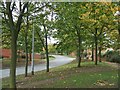
Poplar Avenue with autumn tints
A quiet road on the Bentley Hall Estate. Bentley Hall itself collapsed as a result of coal mining in 1929. The fugitive King Charles II stayed at the Hall during his flight after the battle of Worcester in 1651.
Image: © John M
Taken: 20 Oct 2006
0.19 miles
2
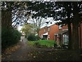
Leafy Close
A small leafy close on the fringes of the Bentley Estate.
Image: © John M
Taken: 20 Oct 2006
0.19 miles
3
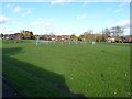
Play area and open space in the Bentley estate
Image: © Richard Law
Taken: 2 Nov 2012
0.19 miles
4
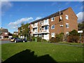
Almond Avenue, Bentley
Block of flats at the end of Almond Avenue. They're solar-panelled right up.
Image: © Richard Law
Taken: 2 Nov 2012
0.22 miles
5
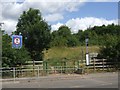
No motorised vehicles allowed on Bentley Haye
Areas of open land on the edge of the conurbation are a magnet for youngsters on their scramble bikes. The Monarch's Way leaves the Country Park to travel the last mile to Bentley Hall on local roads.
Image: © John M
Taken: 13 Jul 2008
0.25 miles