IMAGES TAKEN NEAR TO
Bursnips Road, WOLVERHAMPTON, WV11 2RE
Introduction
This page details the photographs taken nearby to Bursnips Road, WV11 2RE by members of the Geograph project.
The Geograph project started in 2005 with the aim of publishing, organising and preserving representative images for every square kilometre of Great Britain, Ireland and the Isle of Man.

There are currently over 7.5m images from over14,400 individuals and you can help contribute to the project by visiting https://www.geograph.org.uk
Image Map
Images are licensed for reuse under creativecommons.org/licenses/by-sa/2.0
Notes
- Clicking on the map will re-center to the selected point.
- The higher the marker number, the further away the image location is from the centre of the postcode.
Image Listing (11 Images Found)
Images are licensed for reuse under creativecommons.org/licenses/by-sa/2.0
Image
Details
Distance
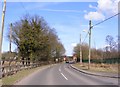
1
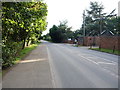
Bursnips Road south of Holly Bank
This section of the A462 runs from junction 11 of the M6, into the northern part of Wednesfield.
Image: © Richard Law
Taken: 22 Sep 2016
0.03 miles
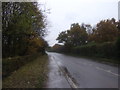
3
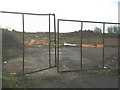
Rather mucky
From the map, I anticipated a pleasant stroll along a footpath just south of a golf course. Tough. This track is currently being used as 4x4 access to some groundworks just behind my right shoulder, and takes a tracked excavator from time to time as well. Very messy as a result.
Image: © Richard Law
Taken: 22 Sep 2016
0.13 miles
5
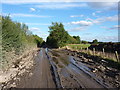
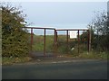
Brownfield Site near Essington
Rosemary Brick and Tile Works occupied this site from 1896 to the mid 1970s. The clay was won from the clay pit on the opposite side of Hobnock Road. This must be a prime site for a new housing development.
Image: © John M
Taken: 11 Nov 2006
0.23 miles
6
Entrance to the clay pit
The tile works across the road used to win clay from this pit until the 1970s. It was later used as a landfill site.
Image: © John M
Taken: 11 Nov 2006
0.23 miles
7
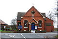
Essington Wood Methodist Church
This church is on the junction of the A462 and the B4156.
Image: © Mick Malpass
Taken: 1 Jan 2012
0.24 miles
9
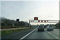
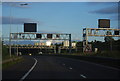
Smart motorway in operation
The M54 is just joining the M6 from the left. It is inappropriate to be using the hard shoulder on this bit.
Image: © Bill Boaden
Taken: 27 Dec 2016
0.25 miles
10
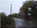
Hobnock Road View
The view along the B4156 Hobnock Road in Essington.
Image: © Gordon Griffiths
Taken: 25 Mar 2018
0.25 miles