IMAGES TAKEN NEAR TO
Alfred Squire Road, WOLVERHAMPTON, WV11 1XU

Introduction

This page details the photographs taken nearby to Alfred Squire Road, WV11 1XU by members of the Geograph project.

The Geograph project started in 2005 with the aim of publishing, organising and preserving representative images for every square kilometre of Great Britain, Ireland and the Isle of Man.

There are currently over 7.5m images from over14,400 individuals and you can help contribute to the project by visiting https://www.geograph.org.uk

Image Map


Images are licensed for reuse under creativecommons.org/licenses/by-sa/2.0
Notes
  • Clicking on the map will re-center to the selected point.
  • The higher the marker number, the further away the image location is from the centre of the postcode.

Image Listing (155 Images Found)

Images are licensed for reuse under creativecommons.org/licenses/by-sa/2.0
  • ...
Image
Details
Distance
1
Final Christmas for Woolworths
The last few days for this household name on the High Street in Wednesfield. Will this lead to the run down of this 'village' shopping centre?
Image: © John M Taken: 25 Dec 2008
0.05 miles
2
Allan Bennett Butchers - Purveyors of prime quality meat
One of three butchers shops on Wednesfield High Street. The windows and interior display the many cups and prize certificates for their award winning sausages.
Image: © John M Taken: 7 Nov 2009
0.05 miles
3
Alfred Squires Road
The view in Wednesfield.
Image: © Gordon Griffiths Taken: 5 Mar 2019
0.05 miles
4
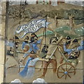
Battle of Wodensfield
Tiled display in a passageway under the 1960s shops. The actual location of the battlefield is unknown but it is thought to be somewhere nearby. In recent years it has been celebrated by re-enactors Image A combined army from Mercia and Wessex trapped a large force of Vikings and inflicted a crushing victory with many thousands killed. This is sometimes referred to as the Battle of Tettenhall (some four miles away).
Image: © John M Taken: 18 Jan 2018
0.05 miles
5
Council Offices, Wednesfield
These were formerly the offices for Wednesfield Urban District Council prior to its amalgamation into Wolverhampton in 1968.
Image: © John M Taken: 15 Sep 2006
0.05 miles
6
Wednesfield Police Station
Viewed from across the old market site. The market stalls have been moved into the High Street.
Image: © John M Taken: 26 Dec 2006
0.05 miles
7
Shops in the High Street
All of the properties on this side of the narrow High Street with the exception of the Dog and Partridge were demolished in the 1960s. The major shop was Woolworths which having been empty for a year has re-opened as Bargain Foods. The market has now moved to the pavement in the High Street and is a shadow of its former self.
Image: © John M Taken: 24 Jan 2010
0.06 miles
8
The ExtraCare Charitable Trust shop
One of a plethora of charity shops and discounters on the High Street.
Image: © John M Taken: 13 Jun 2016
0.06 miles
9
Public mortuary - Wednesfield
This single storey building is where the Coroner's autopsies are performed for Wolverhampton. I worked there in the early 1990s and had had business there earlier in the day, returning to take a quick shot from the road outside. Unfortunately the lighting was terrible.
Image: © Chris Allen Taken: 29 Mar 2019
0.06 miles
10
Dog & Partridge Public House
On High Street, Wednesfield.
Image: © Ian S Taken: 16 Dec 2021
0.06 miles
  • ...