IMAGES TAKEN NEAR TO
Orchard Road, WOLVERHAMPTON, WV11 1LX
Introduction
This page details the photographs taken nearby to Orchard Road, WV11 1LX by members of the Geograph project.
The Geograph project started in 2005 with the aim of publishing, organising and preserving representative images for every square kilometre of Great Britain, Ireland and the Isle of Man.

There are currently over 7.5m images from over14,400 individuals and you can help contribute to the project by visiting https://www.geograph.org.uk
Image Map
Images are licensed for reuse under creativecommons.org/licenses/by-sa/2.0
Notes
- Clicking on the map will re-center to the selected point.
- The higher the marker number, the further away the image location is from the centre of the postcode.
Image Listing (27 Images Found)
Images are licensed for reuse under creativecommons.org/licenses/by-sa/2.0
Image
Details
Distance
2
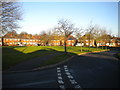
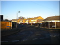
Hazel Grove, Wood End
One of three footpaths lined with prefabricated bungalows between Bellamy Lane (immediately behind the photographer) and Orchard Road.
Image: © Richard Vince
Taken: 28 Dec 2016
0.08 miles
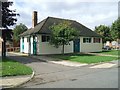
3
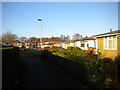
Council Housing - Chestnut Grove
Immediately after the Second World War prefabricated concrete bungalows were offered to local authorities in an attempt to meet a housing shortage. This small estate was built in Wednesfield.The prpoerties had a design life of ten years.
Image: © John M
Taken: 21 Nov 2010
0.09 miles
4
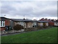
Council Housing - Chestnut Grove
Immediately after the Second World War prefabricated concrete bungalows were offered to local authorities in an attempt to meet a housing shortage. This small estate was built in Wednesfield. These Tarran bungalows had an expected life of ten years.
Image: © John M
Taken: 21 Nov 2010
0.10 miles
5
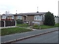
Robin Grove, Wood End
A residential cul de sac off Bellamy Lane.
Image: © Richard Vince
Taken: 28 Dec 2016
0.11 miles
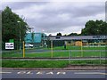
7
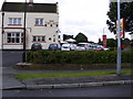
Polling Station - Wolverhampton North East
The hall at Wood End Primary School plays host to a polling station for the 2010 General Election. The school is in an area of predominantly private housing pre and post war. The demographic is a mix of working and middle class.
Image: © John M
Taken: 6 May 2010
0.13 miles
8
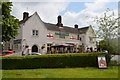
Three Lions Public House (The Red Lion)
A Carlsberg promotion has temporarily re-named pubs in England for the 2016 UEFA Championships.
The strapline is 'If Carlsberg did substitutions'
Image: © John M
Taken: 17 Jun 2016
0.13 miles
9
Wood End Primary School
The new school buildings opened last year.
A polling station for the EU Referendum.
Image: © John M
Taken: 23 Jun 2016
0.13 miles
10
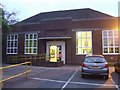
Long Knowle Library
Typical district library built for Wednesfield UDC before incorporation into Wolverhampton. Probably dated late 1950s and now extended to include community facilities.
Image: © John M
Taken: 3 Sep 2006
0.13 miles