
IMAGES TAKEN NEAR TO
Sundour Crescent, WOLVERHAMPTON, WV11 1AP
Introduction
This page details the photographs taken nearby to Sundour Crescent, WV11 1AP by members of the Geograph project.
The Geograph project started in 2005 with the aim of publishing, organising and preserving representative images for every square kilometre of Great Britain, Ireland and the Isle of Man.

There are currently over 7.5m images from over14,400 individuals and you can help contribute to the project by visiting https://www.geograph.org.uk
Image Map
Images are licensed for reuse under creativecommons.org/licenses/by-sa/2.0
Notes
- Clicking on the map will re-center to the selected point.
- The higher the marker number, the further away the image location is from the centre of the postcode.
Image Listing (57 Images Found)
Images are licensed for reuse under creativecommons.org/licenses/by-sa/2.0
Image
Details
Distance
1
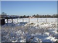
Former sports ground
The former Henry Meadows sports ground in Grassy Lane. Meadows manufactured auto and marine engines from 1922 to 1969, from 1964 owned by Jaguar. The cricket pavilion was soon demolished and the area used for rough grazing. Bordering the Green Belt it has so far escaped housing or other development.
Image: © John M
Taken: 25 Dec 2010
0.06 miles
2
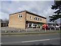
Shop units at Wood Hayes
Shop units dating from 1960s. Tenants have changed over the years with current users, double glazing supplier, electrical shop and florist.
Image: © John M
Taken: 21 Mar 2008
0.08 miles
3
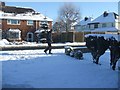
Man on a mission
11-55am on Christmas Day heading to take the mid-day picture.
Image: © John M
Taken: 25 Dec 2010
0.09 miles
4
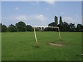
Leaning Goalposts in Public Open Space
Used by the local kids and dog walkers for many years the field is on the edge of the built up area. It remains under threat from housing development. The adjacent former Henry Meadows Sports Club land has lain neglected for several decades.
Image: © John M
Taken: 9 Jun 2007
0.09 miles
5
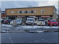
Shops at the Wood Hayes
Hair Salon, Double Glaziers, Florist and most recently a Café replacing the Electrical Shop.
Image: © John M
Taken: 8 Dec 2017
0.10 miles
6
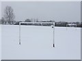
No match today!
Goalposts in public open space on the edge of the city.
Image: © John M
Taken: 24 Mar 2013
0.10 miles
7

No play today
Public open space on the city fringe. The higher ground behind is Bushbury Hill with its reservoirs and communications masts.
Image: © John M
Taken: 11 Dec 2017
0.11 miles
8
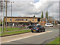
Shops, Blackhalve Lane
A 1960s shop and flat block on the crossroads where Blackhalve Lane meets Wood Hayes Road and Wood End Road.
Image: © Richard Webb
Taken: 1 May 2010
0.11 miles
9
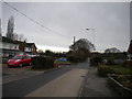
Wood Hayes Road, Wood Hayes
Looking towards Cannock Road from near the junction with Blackhalve Lane.
Image: © Richard Vince
Taken: 27 Dec 2017
0.11 miles
10
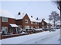
Council Housing - Bealey's Avenue
The Long Knowle Estate in Wednesfield was built in the early 1950s to house overspill from neighbouring Wolverhampton. Typical features are the low brick perimeter walls and brick walls between properties. Building started in October 1953 with the first 100 properties completed in August 1954.
Image: © John M
Taken: 19 Dec 2010
0.12 miles