IMAGES TAKEN NEAR TO
Stanley Road, WOLVERHAMPTON, WV10 9EN
Introduction
This page details the photographs taken nearby to Stanley Road, WV10 9EN by members of the Geograph project.
The Geograph project started in 2005 with the aim of publishing, organising and preserving representative images for every square kilometre of Great Britain, Ireland and the Isle of Man.

There are currently over 7.5m images from over14,400 individuals and you can help contribute to the project by visiting https://www.geograph.org.uk
Image Map
Images are licensed for reuse under creativecommons.org/licenses/by-sa/2.0
Notes
- Clicking on the map will re-center to the selected point.
- The higher the marker number, the further away the image location is from the centre of the postcode.
Image Listing (17 Images Found)
Images are licensed for reuse under creativecommons.org/licenses/by-sa/2.0
Image
Details
Distance
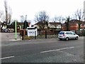
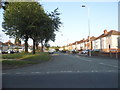
2
Mini roundabout, Bushbury Lane, Bushbury
At the junction with Hammond Avenue (right), which leads up into Bushbury Hill estate, as indicated by the green sign on the right.
Image: © Richard Vince
Taken: 28 Dec 2016
0.15 miles
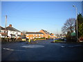
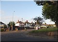
3
Bushbury roundabout
On Bushbury Lane, just north of the Co-op shop.
Image: © Richard Law
Taken: 16 Mar 2012
0.17 miles
4
West end of Low Hill Crescent, Bushbury Hill estate
Despite its name, Low Hill Crescent is actually approximately elliptical. At this point, the west end of it crosses Hammond Avenue.
Image: © Richard Vince
Taken: 28 Dec 2016
0.18 miles
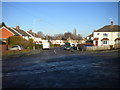
7
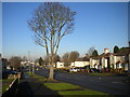
Bare tree on Kempthorne Avenue, Bushbury Hill estate
Looking down the hill towards Bushbury Lane.
Image: © Richard Vince
Taken: 28 Dec 2016
0.22 miles
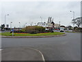
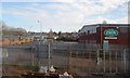
8

Goodyear Neighbourhood Park, Wolverhampton
Looking north-east.
On the right is the only stand of mature trees in the park (formerly called Wingfoot Park) because most of it was developed from around 2010 on part of the demolished Goodyear site. Young trees are being planted, and the park will be very attractive in future years. The trees on the skyine are growing on the railway embankment. The snow is a remnant of the 6-8cm dumped by Storm Arwen three days earlier.
The St Modwen Developments regeneration on the 88 acre former Goodyear tyre factory site has continued for many years, with housing and including the relandscaped Wingfoot Park (now named Goodyear Neighbourhood Park and reopened in 2018).
Image: © Roger Kidd
Taken: 29 Nov 2021
0.23 miles
10
Elston Hall Lane at the corner of Fordhouse Lane
Image: © David Howard
Taken: 3 Jun 2018
0.23 miles