IMAGES TAKEN NEAR TO
School Lane, WOLVERHAMPTON, WV10 8HT
Introduction
This page details the photographs taken nearby to School Lane, WV10 8HT by members of the Geograph project.
The Geograph project started in 2005 with the aim of publishing, organising and preserving representative images for every square kilometre of Great Britain, Ireland and the Isle of Man.

There are currently over 7.5m images from over14,400 individuals and you can help contribute to the project by visiting https://www.geograph.org.uk
Image Map
Images are licensed for reuse under creativecommons.org/licenses/by-sa/2.0
Notes
- Clicking on the map will re-center to the selected point.
- The higher the marker number, the further away the image location is from the centre of the postcode.
Image Listing (39 Images Found)
Images are licensed for reuse under creativecommons.org/licenses/by-sa/2.0
Image
Details
Distance
1
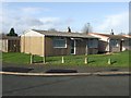
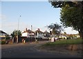
Council Housing - Lincoln Green
Immediate post war prefabricated homes dating from around 1947. Although Wolverhampton had lost a relatively small number of properties to bombing the council still erected a large number of these temporary dwellings. Surprisingly a fair proportion of these remain scattered around the city despite their original ten year design life.
Image: © John M
Taken: 6 Dec 2009
0.11 miles
2
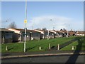
Council Housing - Lincoln Green
Immediate post war prefabricated homes dating from around 1947. Although Wolverhampton had lost a relatively small number of properties to bombing the council still erected a large number of these temporary dwellings. Surprisingly a fair proportion of these remain scattered around the city despite their original ten year design life.
Image: © John M
Taken: 6 Dec 2009
0.13 miles
3
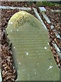
St Mary's Church Bushbury
Grave of Francis Henry Davies, killed in the railway accident at Portobello Junction 19th October 1899. He was Fireman of the express that collided with a goods train. Gravestone flat on ground.
Image: © Ray Durrant
Taken: 20 Mar 2009
0.19 miles
5
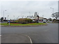
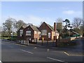
Bushbury roundabout
On Bushbury Lane, just north of the Co-op shop.
Image: © Richard Law
Taken: 16 Mar 2012
0.19 miles
7
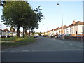
Elston Hall Lane at the corner of Fordhouse Lane
Image: © David Howard
Taken: 3 Jun 2018
0.20 miles
8
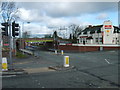
Bushbury Nursery School
The Bushbury Church School was established on this site in 1835.
Image: © John M
Taken: 17 Jan 2010
0.20 miles
9
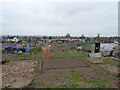
Bushbury Allotments
A significant area of allotments on the west side of Bushbury Hill.
Image: © Richard Law
Taken: 16 Mar 2012
0.20 miles