
IMAGES TAKEN NEAR TO
Beech Road, WOLVERHAMPTON, WV10 6TP
Introduction
This page details the photographs taken nearby to Beech Road, WV10 6TP by members of the Geograph project.
The Geograph project started in 2005 with the aim of publishing, organising and preserving representative images for every square kilometre of Great Britain, Ireland and the Isle of Man.

There are currently over 7.5m images from over14,400 individuals and you can help contribute to the project by visiting https://www.geograph.org.uk
Image Map
Images are licensed for reuse under creativecommons.org/licenses/by-sa/2.0
Notes
- Clicking on the map will re-center to the selected point.
- The higher the marker number, the further away the image location is from the centre of the postcode.
Image Listing (18 Images Found)
Images are licensed for reuse under creativecommons.org/licenses/by-sa/2.0
Image
Details
Distance
1

The Hop Pole, Oxley
Formerly The Oxley Moor Hotel
Image: © Alex McGregor
Taken: 20 Oct 2010
0.08 miles
2
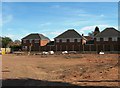
Development on the site of The Homestead
Image: © Alex McGregor
Taken: 23 Apr 2013
0.13 miles
3
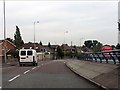
Split-level carriageways, Stafford Road (A449)
Image: © J Whatley
Taken: 6 Sep 2010
0.14 miles
4

Stafford Road near Oxley in Wolverhampton
This is the A449, looking north towards Wolverhampton City Centre from near the junction with Oxley Moor Road (off to the right).
Image: © Roger Kidd
Taken: 29 Nov 2021
0.15 miles
5

Stafford Road near Oxley in Wolverhampton
This is the A449, looking north towards Wolverhampton City Centre at the junction with Oxley Moor Road.
Image: © Roger Kidd
Taken: 29 Nov 2021
0.17 miles
7

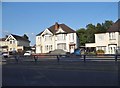
Stafford Road near Oxley in Wolverhampton
This is the A449, looking north towards Wolverhampton City Centre from near the junction with Oxley Moor Road (off to the right).
Image: © Roger Kidd
Taken: 29 Nov 2021
0.19 miles
8
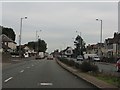
Stafford Road (A449) approaching Oxley Moor Road junction
Image: © J Whatley
Taken: 6 Sep 2010
0.20 miles
9

Lymer Road near Oxley in Wolverhampton
Looking south from near the junction with Church Road.
Image: © Roger Kidd
Taken: 29 Nov 2021
0.21 miles
10
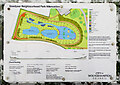
Pond plan in Goodyear Neighbourhood Park, Wolverhampton
By Ranger Drive, the three connected pools have been designed to function as a balancing (or attenuation) pond, and also act as a local nature reserve providing slightly different habitats. https://www.sabre-roads.org.uk/wiki/?title=Balancing_Pond
Image]
The St Modwen Developments regeneration on the 88 acre former Goodyear tyre factory site has continued for many years, with housing and the relandscaped Wingfoot Park (now named Goodyear Neighbourhood Park and reopened in 2018). The park needs more trees, and some have been planted, and the area will be even more attractive in future years. There is a basketball/handball court, tennis courts and a children's play area.
Image: © Roger Kidd
Taken: 29 Nov 2021
0.22 miles