
IMAGES TAKEN NEAR TO
Culwell Industrial Park, Kennedy Road, WOLVERHAMPTON, WV10 0LL
Introduction
This page details the photographs taken nearby to Culwell Industrial Park, Kennedy Road, WV10 0LL by members of the Geograph project.
The Geograph project started in 2005 with the aim of publishing, organising and preserving representative images for every square kilometre of Great Britain, Ireland and the Isle of Man.

There are currently over 7.5m images from over14,400 individuals and you can help contribute to the project by visiting https://www.geograph.org.uk
Image Map
Images are licensed for reuse under creativecommons.org/licenses/by-sa/2.0
Notes
- Clicking on the map will re-center to the selected point.
- The higher the marker number, the further away the image location is from the centre of the postcode.
Image Listing (687 Images Found)
Images are licensed for reuse under creativecommons.org/licenses/by-sa/2.0
Image
Details
Distance
1
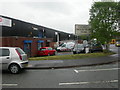
Wolverhampton, Culwell Industrial Park
In Kennedy Road, off Culwell Road; once a maze of metal-working workshops, now small-scale services.
Image: © Mike Faherty
Taken: 27 Apr 2009
0.04 miles
2
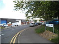
Kennedy Road Junction
The view of the junction with Culwell Street in Wolverhampton.
Image: © Gordon Griffiths
Taken: 20 Jun 2014
0.05 miles
3
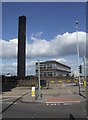
Council Services Depot - Culwell Street
Operating base for council vehicles, road sweepers, gritters and social services minibuses.
Image: © John M
Taken: 29 Aug 2010
0.07 miles
4
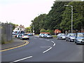
Culwell Street
The street view in Wolverhampton.
Image: © Gordon Griffiths
Taken: 20 Jun 2014
0.07 miles
5
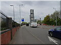
Tower View
The view down the Wolverhampton (A4124) road near Sun Street towards the city centre and the University's Victoria Hall.
Image: © Gordon Griffiths
Taken: 27 Apr 2022
0.07 miles
6
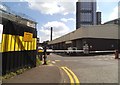
Council Yard
The view of the depot off Culwell Street with Wolverhampton University's Victoria Hall in the background.
Image: © Gordon Griffiths
Taken: 20 Jun 2014
0.07 miles
7
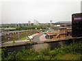
The Blue Brick and Wednesfield Road.
Taken from the station. Heath Town tower blocks in the distance.
Image: © Annette Randle
Taken: 29 May 2008
0.07 miles
8
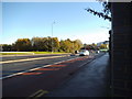
Wednesfield Road
The view down the A4124 in Wolverhampton.
Image: © Gordon Griffiths
Taken: 10 Nov 2013
0.08 miles
9
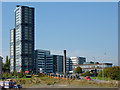
Building site and Victoria Hall, Wolverhampton
It appears that building is about to start on the site by Sun Street and Wednesfield Road. The new buildings beyond the road were completed in 2009 for the University of Wolverhampton students. John M. reports that this is at present the tallest modular building in the country and houses around 650 students. Image]
Image: © Roger D Kidd
Taken: 30 Sep 2011
0.08 miles
10
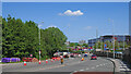
Wednesfield Road leaving Wolverhampton city centre
This is the A4124 to Heath Town, Wednesfield, Bloxwich and Brownhills.
The enormous warehouse on the left is the North-west Midlands Mail Centre (Wolverhampton Delivery office - Royal Mail) in Sun Street.
Image: © Roger Kidd
Taken: 14 May 2022
0.08 miles