
IMAGES TAKEN NEAR TO
Hilton Street, WOLVERHAMPTON, WV10 0LF
Introduction
This page details the photographs taken nearby to Hilton Street, WV10 0LF by members of the Geograph project.
The Geograph project started in 2005 with the aim of publishing, organising and preserving representative images for every square kilometre of Great Britain, Ireland and the Isle of Man.

There are currently over 7.5m images from over14,400 individuals and you can help contribute to the project by visiting https://www.geograph.org.uk
Image Map
Images are licensed for reuse under creativecommons.org/licenses/by-sa/2.0
Notes
- Clicking on the map will re-center to the selected point.
- The higher the marker number, the further away the image location is from the centre of the postcode.
Image Listing (214 Images Found)
Images are licensed for reuse under creativecommons.org/licenses/by-sa/2.0
Image
Details
Distance
1
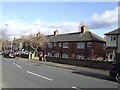
Council Housing - Hilton Street
Mid 1930s council housing with the chacteristic hollow block concrete garden wall used on all of the estates of the period.
Image: © John M
Taken: 13 Nov 2010
0.03 miles
2
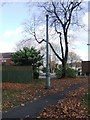
Sewer Vent Pipe - Tremaine Gardens
A remnant from the period of the Victorian terraced housing demolished in the 1980s and replaced by council housing. There are a number of these vent pipes around the city including Grade II and locally listed examples.
Image: © John M
Taken: 13 Nov 2010
0.04 miles
3
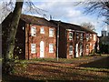
Council Housing - Tremaine Gardens
Late 1980s housing in a woodland setting.
Image: © John M
Taken: 13 Nov 2010
0.04 miles
4
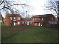
Council Housing - Tremaine Gardens
Late 1980s housing estate replacing Victorian terraces next to Springfield Brewery. A curiously large open space with trees forms a central feature of the estate.
Image: © John M
Taken: 13 Nov 2010
0.05 miles
5
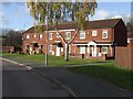
Council Housing - Tremaine Gardens
Late 1980s housing estate replacing Victorian terraces next to Springfield Brewery.
Image: © John M
Taken: 13 Nov 2010
0.06 miles
6
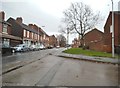
Yarwell Close View
The view down Hilton Street in Springfield, Wolverhampton.
Image: © Gordon Griffiths
Taken: 8 Nov 2014
0.08 miles
7
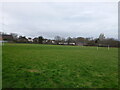
Playing fields south of Woden Primary School
Football fields which are presumably connected to, or owned by, the school; that said, the scale of the pitches and size of the goals seems a bit large for 'primary school' children.
Image: © Richard Law
Taken: 4 Feb 2025
0.09 miles
8
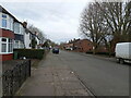
Springfield Road, Wolverhampton
Houses of the 1950s or thereabouts on Springfield Road
Image: © Richard Law
Taken: 4 Feb 2025
0.10 miles
9
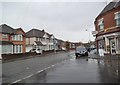
Springfield Road Shops
The view in Springfield, Wolverhampton.
Image: © Gordon Griffiths
Taken: 8 Nov 2014
0.10 miles
10
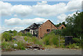
Derelict land and building in Springfield, Wolverhampton
This ex Springfield Brewery site is earmarked for development by Bryant Homes. One/two bedroom apartments, and three/four bedroom houses are planned.
Image: © Roger D Kidd
Taken: 10 Aug 2012
0.11 miles