
IMAGES TAKEN NEAR TO
Grosvenor Street, WOLVERHAMPTON, WV10 0EJ
Introduction
This page details the photographs taken nearby to Grosvenor Street, WV10 0EJ by members of the Geograph project.
The Geograph project started in 2005 with the aim of publishing, organising and preserving representative images for every square kilometre of Great Britain, Ireland and the Isle of Man.

There are currently over 7.5m images from over14,400 individuals and you can help contribute to the project by visiting https://www.geograph.org.uk
Image Map
Images are licensed for reuse under creativecommons.org/licenses/by-sa/2.0
Notes
- Clicking on the map will re-center to the selected point.
- The higher the marker number, the further away the image location is from the centre of the postcode.
Image Listing (84 Images Found)
Images are licensed for reuse under creativecommons.org/licenses/by-sa/2.0
Image
Details
Distance
1
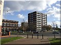
Council Housing - Inkerman Street
The Heath Town Estate was opened by Princess Margaret in 1969.
Image: © John M
Taken: 13 Nov 2010
0.08 miles
2
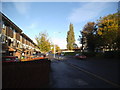
Inkerman Street
The view down the Wolverhampton street.
Image: © Gordon Griffiths
Taken: 10 Nov 2013
0.08 miles
4
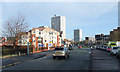
Towards Heath Town, Wolverhampton
This is the Wednesfield Road (A4124 to Bloxwich and Brownhills) and the high rise flats ahead are in Heath Town. New housing on the left has been developed on the "brown field site" formerly occupied by the Chubb Works, and more is taking place. One wonders how sales and lettings are faring in this year's credit crunch climate! The traffic hold-up approaching Wolverhampton at this "quieter" time of day is caused because half the road is designated for buses and other public transport only, leaving the single lane for everybody else as an even more congested bottleneck.
Image: © Roger D Kidd
Taken: 17 Dec 2008
0.10 miles
5
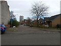
Houses on Hemmings Close, Springfield
The bungalows on the right face into Hemmings Close here, and their rears are presented to the much busier and noisier Wednesfield Road.
Image: © Richard Law
Taken: 4 Feb 2025
0.10 miles
6
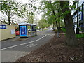
Wednesfield Road Scene
The view down the A4124 in Wolverhampton.
Image: © Gordon Griffiths
Taken: 27 Apr 2022
0.11 miles
7
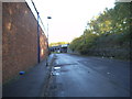
Freeman Street
The view down the Wolverhampton street alongside the railway line.
Image: © Gordon Griffiths
Taken: 10 Nov 2013
0.11 miles
8
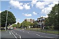
Wednesfield Road Crossing
The view of the A4124 from Burton Road in Springfield, Wolverhampton.
Image: © Gordon Griffiths
Taken: 20 Jun 2014
0.11 miles
9
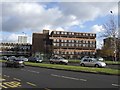
Council Housing - Chervil Rise
Deck access flats dating from around 1969 on the Heath Town Estate. The flats replaced earlier Victorian terraced housing.
Image: © John M
Taken: 13 Nov 2010
0.11 miles
10
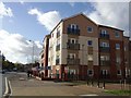
Private Housing - Wednesfield Road
The new housing development in the heart of the 1960s Heath Town Estate on the site of the former Chubb safe factory. A large number of the properties are for sale or rent.
Image: © John M
Taken: 13 Nov 2010
0.12 miles