IMAGES TAKEN NEAR TO
Chester Road, WALSALL, WS9 9HH
Introduction
This page details the photographs taken nearby to Chester Road, WS9 9HH by members of the Geograph project.
The Geograph project started in 2005 with the aim of publishing, organising and preserving representative images for every square kilometre of Great Britain, Ireland and the Isle of Man.

There are currently over 7.5m images from over14,400 individuals and you can help contribute to the project by visiting https://www.geograph.org.uk
Image Map
Images are licensed for reuse under creativecommons.org/licenses/by-sa/2.0
Notes
- Clicking on the map will re-center to the selected point.
- The higher the marker number, the further away the image location is from the centre of the postcode.
Image Listing (6 Images Found)
Images are licensed for reuse under creativecommons.org/licenses/by-sa/2.0
Image
Details
Distance
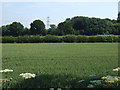
3
Crossroads and Harvest
The hot dry weather this year has enabled the harvest to be completed very early. This crossroads is formed where the A452 and local lanes meet.
Image: © Michael Patterson
Taken: 25 Jul 2006
0.16 miles
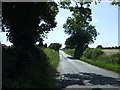
4
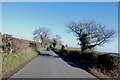
Gravelley Lane off the A452 Chester Road, Stonnall
Image: © Mick Malpass
Taken: 11 Feb 2012
0.16 miles
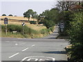
5
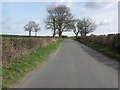
Junction of Gravelly Lane and Church Road
Image: © Adrian Rothery
Taken: 24 Mar 2009
0.21 miles