IMAGES TAKEN NEAR TO
Doe Bank Lane, WALSALL, WS9 0RQ
Introduction
This page details the photographs taken nearby to Doe Bank Lane, WS9 0RQ by members of the Geograph project.
The Geograph project started in 2005 with the aim of publishing, organising and preserving representative images for every square kilometre of Great Britain, Ireland and the Isle of Man.

There are currently over 7.5m images from over14,400 individuals and you can help contribute to the project by visiting https://www.geograph.org.uk
Image Map
Images are licensed for reuse under creativecommons.org/licenses/by-sa/2.0
Notes
- Clicking on the map will re-center to the selected point.
- The higher the marker number, the further away the image location is from the centre of the postcode.
Image Listing (14 Images Found)
Images are licensed for reuse under creativecommons.org/licenses/by-sa/2.0
Image
Details
Distance
1
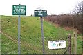
Doe Bank Park
This "park" is really just a farmer's field that the council bought to provide a recreation area for the people of Pheasey. Unfortunately a lot of the recreation that goes on here isn't what the local aldermen had in mind.
Image: © Adrian Bailey
Taken: 16 Mar 2005
0.06 miles

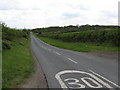
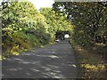
3
Doe Bank Lane
The view along Doe Bank Lane from the Pheasey Surface Block (a sort of trig point), which consists of the lump of concrete bottom right, containing a brass bolt about 1" across. Details at http://www.trigpointinguk.com/trigs/trig-details.php?t=241
Image: © Richard Law
Taken: 12 Jun 2013
0.15 miles
4
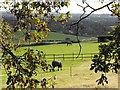
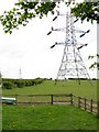
View south from Bridle Lane
Across horse paddocks towards central Birmingham.
Image: © Penny Mayes
Taken: 27 Oct 2012
0.18 miles
5
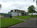
Disused building on the playing fields
As others have noted, the Pheasey Playing Fields-cum-park are not the most attractive area, and this badly graffitied building does little for the ambience. The nearby children's play area behind the fence on the left is reasonably well kept.
Image: © Richard Law
Taken: 12 Jun 2013
0.18 miles
8
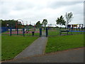
Children's Play Area at Doe Bank Wood
A newish park on the Pheasey Recreation fields.
Image: © Richard Law
Taken: 12 Jun 2013
0.19 miles
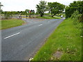
9
Bridle Lane
This lane skirts the southern edge of Barr Beacon.
Image: © Penny Mayes
Taken: 27 Oct 2012
0.19 miles