IMAGES TAKEN NEAR TO
Jacobs Hall Lane, WALSALL, WS6 6AD
Introduction
This page details the photographs taken nearby to Jacobs Hall Lane, WS6 6AD by members of the Geograph project.
The Geograph project started in 2005 with the aim of publishing, organising and preserving representative images for every square kilometre of Great Britain, Ireland and the Isle of Man.

There are currently over 7.5m images from over14,400 individuals and you can help contribute to the project by visiting https://www.geograph.org.uk
Image Map
Images are licensed for reuse under creativecommons.org/licenses/by-sa/2.0
Notes
- Clicking on the map will re-center to the selected point.
- The higher the marker number, the further away the image location is from the centre of the postcode.
Image Listing (11 Images Found)
Images are licensed for reuse under creativecommons.org/licenses/by-sa/2.0
Image
Details
Distance
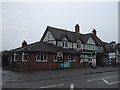
1
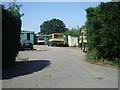
Green Bus Service Depot
De-regulation of bus services led to a number of small operators. The 'Green Bus' operate services between Cannock, Wolverhampton and Walsall passing through the old mining villages.
Services ceased in November 2009 when the operators licence was revoked for a year by the Traffic Commissioners. Many of the routes are now operated by Arriva.
Image: © John M
Taken: 10 Jun 2008
0.02 miles
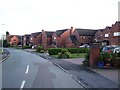
2
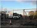
Development site off Jacob's Hall Lane
Image: © Alex McGregor
Taken: 3 Dec 2014
0.04 miles
6
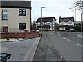
Jacob's Hall Lane joins the A34 Walsall Road
Image: © Richard Law
Taken: 14 Jan 2019
0.14 miles
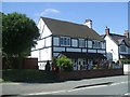
8
The Wheatsheaf, Great Wyrley
On Walsall Road.
Image: © JThomas
Taken: 9 Nov 2019
0.20 miles
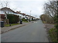
9
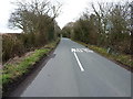
West on Jacob's Hall Lane
Approaching the outskirts of Great Wyrley and Landywood from the east; a certain amount of fly-tipping detritus lies in the roadside ditches.
Image: © Richard Law
Taken: 14 Jan 2019
0.22 miles
10
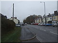
Walsall Road (A34), Great Wyrley
Towards Cannock.
Image: © JThomas
Taken: 9 Nov 2019
0.23 miles