
IMAGES TAKEN NEAR TO
Parklime Drive, WALSALL, WS4 2HH
Introduction
This page details the photographs taken nearby to Parklime Drive, WS4 2HH by members of the Geograph project.
The Geograph project started in 2005 with the aim of publishing, organising and preserving representative images for every square kilometre of Great Britain, Ireland and the Isle of Man.

There are currently over 7.5m images from over14,400 individuals and you can help contribute to the project by visiting https://www.geograph.org.uk
Image Map
Images are licensed for reuse under creativecommons.org/licenses/by-sa/2.0
Notes
- Clicking on the map will re-center to the selected point.
- The higher the marker number, the further away the image location is from the centre of the postcode.
Image Listing (6 Images Found)
Images are licensed for reuse under creativecommons.org/licenses/by-sa/2.0
Image
Details
Distance
1

Park Lime Pits - main pool
The dark end of the main pool when there is leaf cover during summer. This image taken early March, mid afternoon on a bright day.
Image: © Roger Jones
Taken: 3 Mar 2010
0.08 miles
2

Stubble Field conservation project near Walsall
The info board shows how this area is leaving strips of land free from pesticides and fertilisers and stubble extant in order to provide cover and food for finches, Yellowhammers and Reed Buntings.
Image: © Jeremy Bolwell
Taken: 26 Nov 2009
0.12 miles
3
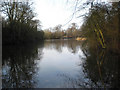
Park Lime Pits - main pool
Looking north from the far end of the main pool at Park Lime Pits, Rushall. Taken mid afternoon early March 2010.
Image: © Roger Jones
Taken: 3 Mar 2010
0.15 miles

5

Park Lime Pits - upper pool
This image was taken mid afternoon in early March 2010. The lakes were formed from dis-used lime excavations. This is the smaller upper lake. The water is at high level as can be seen from the submerged board-walk in front of the seating
Image: © Roger Jones
Taken: 3 Mar 2010
0.21 miles
6

Ruined barn in the grounds of Rushall Old Hall
Not easy to approach or photograph (the grounds of Rushall Hall are not particularly open) this barn structure is described in its 1986 Grade II listing https://britishlistedbuildings.co.uk/101076369-barn-approximately-30-metres-south-west-of-gatehouse-at-rushall-hall-st-matthews-ward#.XAbDeNSLTGg as circa 1700, and as having a slate roof. That, rather sadly, appears to be no longer the case at this end at any rate, and the structure may be considered 'At Risk' as it stands. It lies close to the site of the medieval vill(age) and fortified house of Rushall , the main part of which is a Scheduled Ancient Monument https://historicengland.org.uk/listing/the-list/list-entry/1013153 dating back to the 14th century.
Image: © Richard Law
Taken: 24 Oct 2018
0.23 miles