IMAGES TAKEN NEAR TO
Lichfield Road, WALSALL, WS4 2DJ
Introduction
This page details the photographs taken nearby to Lichfield Road, WS4 2DJ by members of the Geograph project.
The Geograph project started in 2005 with the aim of publishing, organising and preserving representative images for every square kilometre of Great Britain, Ireland and the Isle of Man.

There are currently over 7.5m images from over14,400 individuals and you can help contribute to the project by visiting https://www.geograph.org.uk
Image Map
Images are licensed for reuse under creativecommons.org/licenses/by-sa/2.0
Notes
- Clicking on the map will re-center to the selected point.
- The higher the marker number, the further away the image location is from the centre of the postcode.
Image Listing (22 Images Found)
Images are licensed for reuse under creativecommons.org/licenses/by-sa/2.0
Image
Details
Distance
1
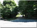
Harpur Road
At the junction with Lichfield Road A461
Image: © Adrian Rothery
Taken: 1 Aug 2008
0.02 miles
2
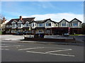
The Beverley Hotel
An apparent conversion of several houses on the east side of Lichfield Road.
Image: © Richard Law
Taken: 24 Oct 2018
0.04 miles
3
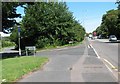
Cartbridge Lane South
At the junction with Lichfield Road A461
Image: © Adrian Rothery
Taken: 1 Aug 2008
0.05 miles
5
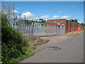
Electricity Station
Cartbridge Lane South. Notice the black box half way up on the lamp post, it's a sign that lights up to say CCTV is in operation.
Image: © Adrian Rothery
Taken: 1 Aug 2008
0.15 miles
6
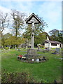
Rushall War Memorial
Situated in the graveyard of St Michael's church, and erected in January 1919, very soon after the end of WWI; it's made of carved oak on a sandstone base. Grade II listed https://britishlistedbuildings.co.uk/101432999-rushall-war-memorial-st-matthews-ward#.XAZ7A9SLTGg in 2016.
Image: © Richard Law
Taken: 24 Oct 2018
0.15 miles
7
Churchyard, St Michael The Archangel, Rushall
Image: © Geoff Pick
Taken: 15 Sep 2007
0.16 miles
8
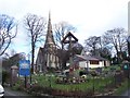
St Michael The Archangel, Rushall
A rather bleak view with the trees stripped of their foliage.
Image: © Adrian Rothery
Taken: 9 Mar 2007
0.17 miles
9
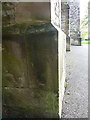
OS benchmark - Walsall, St Michael's church
An OS cutmark on the wall of the church; originally levelled, probably in 1947, at 139.827m above Ordnance Datum Newlyn.
Image: © Richard Law
Taken: 24 Oct 2018
0.18 miles