
IMAGES TAKEN NEAR TO
Mill Lane, WALSALL, WS4 2BH
Introduction
This page details the photographs taken nearby to Mill Lane, WS4 2BH by members of the Geograph project.
The Geograph project started in 2005 with the aim of publishing, organising and preserving representative images for every square kilometre of Great Britain, Ireland and the Isle of Man.

There are currently over 7.5m images from over14,400 individuals and you can help contribute to the project by visiting https://www.geograph.org.uk
Image Map
Images are licensed for reuse under creativecommons.org/licenses/by-sa/2.0
Notes
- Clicking on the map will re-center to the selected point.
- The higher the marker number, the further away the image location is from the centre of the postcode.
Image Listing (40 Images Found)
Images are licensed for reuse under creativecommons.org/licenses/by-sa/2.0
Image
Details
Distance
1
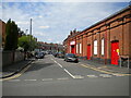
Eastbourne Street, Walsall
Off Butts Road.
Image: © Richard Vince
Taken: 29 May 2021
0.06 miles
2
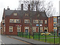
Butts Tavern, Walsall
Unfortunately missing half its name, this rather grand building is very much a community pub serving this district of Walsall a short distance from the town centre.
Image: © Stephen McKay
Taken: 9 Feb 2020
0.07 miles
3
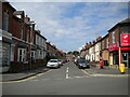
Westbourne Street, Walsall
Off Butts Road.
Image: © Richard Vince
Taken: 29 May 2021
0.09 miles
4
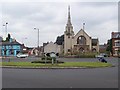
Derelict Methodist Church, Walsall
This is the view that greets drivers as they arrive in the town on the A454 from Aldridge. Structurally unsafe, it can't be long before the church is pulled down. It was built in 1910 and provides an interesting symmetry with the equally grand methodist church at the start of the A454 in Sutton Coldfield (Image).
Image: © Adrian Bailey
Taken: 31 Jul 2005
0.09 miles
5
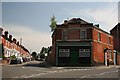
Converted Building
This building, situated on the corner of Butts Road and William Street, looks as if it was once either a shop or public house.
Image: © Derek Bennett
Taken: 27 Jul 2008
0.09 miles
6
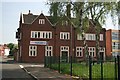
The BB Pub
This old pub now seems to have the name "BB". It's not a pub I know or have ever frequented, but it's an interesting old building.
Image: © Derek Bennett
Taken: 11 May 2008
0.09 miles
7
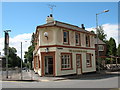
The Hatherton Arms
Butts Road, Walsall.
See this pub in a rather ghastly pale blue here: Image
Image: © Adrian Rothery
Taken: 1 Aug 2008
0.11 miles
8
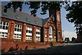
Disused School
This old school, situated on the corner of Butts Road and William Street, is no longer in use as a school.
Image: © Derek Bennett
Taken: 27 Jul 2008
0.11 miles
9

Land beside the Ford Brook
The Ford Brook flows in a deep channel to the left of the picture.
Image: © John M
Taken: 8 Sep 2012
0.11 miles
10
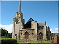
Derelict Methodist Church, Walsall
The large crack in the front wall was caused by subsidence. The church has stood empty for many years due to the subsidence damage while a decision on its future was waiting to be made. Sadly an arsonist has now more or less made the decision final.
Condition before the fire here: Image
Image: © Adrian Rothery
Taken: 1 Aug 2008
0.11 miles