
IMAGES TAKEN NEAR TO
Teddesley Street, WALSALL, WS4 2AL
Introduction
This page details the photographs taken nearby to Teddesley Street, WS4 2AL by members of the Geograph project.
The Geograph project started in 2005 with the aim of publishing, organising and preserving representative images for every square kilometre of Great Britain, Ireland and the Isle of Man.

There are currently over 7.5m images from over14,400 individuals and you can help contribute to the project by visiting https://www.geograph.org.uk
Image Map
Images are licensed for reuse under creativecommons.org/licenses/by-sa/2.0
Notes
- Clicking on the map will re-center to the selected point.
- The higher the marker number, the further away the image location is from the centre of the postcode.
Image Listing (62 Images Found)
Images are licensed for reuse under creativecommons.org/licenses/by-sa/2.0
Image
Details
Distance
1
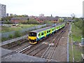
Central Trains DMU 150009
Central Trains DMU (Diesel Multiple Unit) 150009 heading south towards Walsall station, with service from Rugeley Town.
Image: © Adrian Rothery
Taken: 2 May 2006
0.09 miles
2
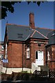
Girls School Entrance
This is the old 'girls' entrance to the disused school in the Butts Road, Walsall.
Image: © Derek Bennett
Taken: 27 Jul 2008
0.10 miles
3
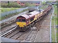
EWS Class 66001
EWS (English Welsh and Scottish) Class 66001 heading north from Walsall with a mix of empty and full wagons.
Image: © Adrian Rothery
Taken: 2 May 2006
0.10 miles
4
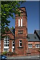
School tower
This tower belongs to a disused schoolhouse. The carved stone plaque on the tower is dated 1879.
Image: © Derek Bennett
Taken: 27 Jul 2008
0.10 miles
5
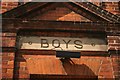
Boys Entrance
This is a reminder of the segregation of 'boys' and 'girls' in our old schools.
The building this entrance belongs to is no longer used as a school.
Image: © Derek Bennett
Taken: 27 Jul 2008
0.10 miles
6
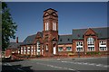
Old Schoolhouse
This disused school on the corner of Butts Road and William Street still has its old 'Boys' and 'Girls' entrance signs.
Image: © Derek Bennett
Taken: 27 Jul 2008
0.10 miles
7

OS Cut Mark - Walsall, Upper Forster Street, Queen Mary's High
Cut Mark, Upper Forster Street
Image: © thejackrustles
Taken: 28 Aug 2016
0.10 miles
8
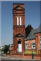
Disused School Tower with Boys entrance
The tower was the grand entrance to the 'Boys' entrance of this disused school, the girls entrance was a modest door further down the building.
Image: © Derek Bennett
Taken: 27 Jul 2008
0.11 miles
9

Littleton Road East
Walsall roadworks.
Image: © Gordon Griffiths
Taken: 18 Nov 2008
0.11 miles
10
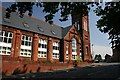
Disused School
This old school, situated on the corner of Butts Road and William Street, is no longer in use as a school.
Image: © Derek Bennett
Taken: 27 Jul 2008
0.11 miles