
IMAGES TAKEN NEAR TO
Stafford Street, WALSALL, WS2 8DG
Introduction
This page details the photographs taken nearby to Stafford Street, WS2 8DG by members of the Geograph project.
The Geograph project started in 2005 with the aim of publishing, organising and preserving representative images for every square kilometre of Great Britain, Ireland and the Isle of Man.

There are currently over 7.5m images from over14,400 individuals and you can help contribute to the project by visiting https://www.geograph.org.uk
Image Map
Images are licensed for reuse under creativecommons.org/licenses/by-sa/2.0
Notes
- Clicking on the map will re-center to the selected point.
- The higher the marker number, the further away the image location is from the centre of the postcode.
Image Listing (128 Images Found)
Images are licensed for reuse under creativecommons.org/licenses/by-sa/2.0
Image
Details
Distance
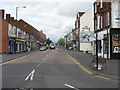
2
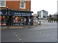
White Mountain
The Walsall outdoors shop on the corner of Stafford Street and Court Way. The white building in the background is Walsall Police Station.
Image: © Gordon Griffiths
Taken: 13 Feb 2010
0.03 miles
3

Walsall - The Prince
On Stafford Street. For an alternative view, please see Image
Image: © Dave Bevis
Taken: 12 Apr 2014
0.04 miles
4

The Oak Inn
A pub on Green Lane, Walsall, which runs out from the town centre towards Birchills.
Image: © Richard Law
Taken: 21 Mar 2014
0.04 miles
5

OS benchmark - Walsall, Salvation Army citadel
A rather shabby OS cutmark on the front face of the Salvation Army building on Green Lane; originally levelled at 126.462m above Ordnance Datum Newlyn.
Image: © Richard Law
Taken: 21 Mar 2014
0.05 miles
6

Walsall - Salvation Army citadel
On Green Lane.
Image: © Dave Bevis
Taken: 12 Apr 2014
0.06 miles
7

Old Walsall College, Main Entrance
This was the main entrance to the old, now gone, Walsall College. There have been some newer bits added since my days as a student there from 1963 to 1965 when it was known as the 'Walsall Technical College'. The white part of the building with 'Walsall First' written on it was an addition. The part it has been added to was the main hall where we took our exams and had some fun on Saturday Nights at the college dances where local live rock and roll bands used to play. The college closed when the new college building was completed.
Image: © Derek Bennett
Taken: 27 Jul 2008
0.07 miles
8
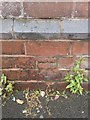
OS Cut Mark: Walsall, Salvation Army Building on Green Lane
Ordnance Survey Cut Mark: Walsall, Salvation Army Building on Green Lane
Image: © thejackrustles
Taken: 7 Jun 2014
0.07 miles
9
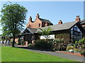
Walsall Leather Museum
Leather Museum - Littleton St West, Walsall - Memories of Walsall's past main industry.
Image: © David Barnes
Taken: 5 May 2006
0.07 miles
10
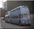
Trolleybuses in Walsall town centre
Sunbeam F4A trolleybus 855 (TDH 905) in Townend Street, WS2 8LP, waiting to depart on Service 33 to Cavendish Road (Bloxwich Lane). Trolleybus 850 (HBE 541) is pictured behind it.
Image: © David Hillas
Taken: 20 Sep 1969
0.08 miles