IMAGES TAKEN NEAR TO
Quarry Close, RUGELEY, WS15 2YB
Introduction
This page details the photographs taken nearby to Quarry Close, WS15 2YB by members of the Geograph project.
The Geograph project started in 2005 with the aim of publishing, organising and preserving representative images for every square kilometre of Great Britain, Ireland and the Isle of Man.

There are currently over 7.5m images from over14,400 individuals and you can help contribute to the project by visiting https://www.geograph.org.uk
Image Map
Images are licensed for reuse under creativecommons.org/licenses/by-sa/2.0
Notes
- Clicking on the map will re-center to the selected point.
- The higher the marker number, the further away the image location is from the centre of the postcode.
Image Listing (16 Images Found)
Images are licensed for reuse under creativecommons.org/licenses/by-sa/2.0
Image
Details
Distance
1
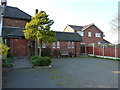
St John the Baptist
A tiny church tucked away in Slitting Mill, just outside Rugeley
Image: © Richard Law
Taken: 2 May 2013
0.06 miles
2
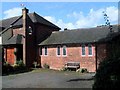
St. John The Baptist, Slitting Mill
A curious church that is integral with the semi-detached house next door
Image: © Geoff Pick
Taken: 19 Sep 2006
0.08 miles
3
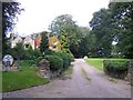
The Stone House, Slitting Mill
Dating from 1584
Image: © Geoff Pick
Taken: 19 Sep 2006
0.08 miles
4
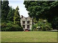
The Stone House, Slitting Mill
Parts of the house date from 1583 when it was owned by a cousin of the Weston family of Hagley Hall. The building has been extended and re-modelled over the years and has seen many uses including as a country hotel and occupation by the RAF during the Second World War.
Image: © John M
Taken: 8 Jun 2008
0.09 miles
5
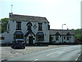
Horns Inn
Historical pub, in Slitting Mill,2008
Image: © Stephen Adams
Taken: 8 May 2008
0.16 miles
6
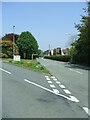
Slitting Mill Road
View from bottom of Post Office Lane, up Slitting Mill Road, 2008
Image: © Stephen Adams
Taken: 8 May 2008
0.16 miles
7
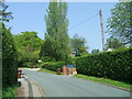
Post Office Lane 2008
View up Post office Lane, 2008 - the historic post office (many years ago) was on the left where the left hand bin is.
Image: © Stephen Adams
Taken: 8 May 2008
0.16 miles
8
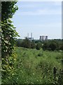
Rising Brook Valley
Rough grazing covers the slopes of the valley as it opens out on to the plain of the River Trent. The cooling towers of Rugeley B Power Station dominate views from the eastern side of Cannock Chase. Collieries about the Chase supplied the coal. Less impressive since the cooling towers of the adjacent Rugeley A station were demolished.
Image: © John M
Taken: 8 Jun 2008
0.17 miles