
IMAGES TAKEN NEAR TO
Wolseley Road, RUGELEY, WS15 2QT
Introduction
This page details the photographs taken nearby to Wolseley Road, WS15 2QT by members of the Geograph project.
The Geograph project started in 2005 with the aim of publishing, organising and preserving representative images for every square kilometre of Great Britain, Ireland and the Isle of Man.

There are currently over 7.5m images from over14,400 individuals and you can help contribute to the project by visiting https://www.geograph.org.uk
Image Map
Images are licensed for reuse under creativecommons.org/licenses/by-sa/2.0
Notes
- Clicking on the map will re-center to the selected point.
- The higher the marker number, the further away the image location is from the centre of the postcode.
Image Listing (83 Images Found)
Images are licensed for reuse under creativecommons.org/licenses/by-sa/2.0
Image
Details
Distance
1
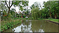
Canal at Brindley Bank in Rugeley, Staffordshire
This is the Trent and Mersey Canal turning left after crossing the aqueduct over the River Trent. The housing is in Albany Drive.
Image: © Roger Kidd
Taken: 17 Oct 2011
0.08 miles
2
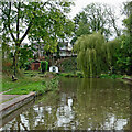
Canal at Brindley Bank in Rugeley, Staffordshire
This is the Trent and Mersey Canal turning left after crossing the aqueduct over the River Trent. The housing is in Albany Drive.
Image: © Roger Kidd
Taken: 17 Oct 2011
0.08 miles
3
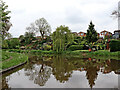
Canal at Brindley Bank in Rugeley, Staffordshire
The housing at the top of the bank is in Albany Drive.
Image: © Roger D Kidd
Taken: 18 May 2019
0.10 miles
4

Trent & Mersey Canal, Rugeley
After crossing the River Trent by means of an aqueduct, the canal makes a right angled turn overlooked by houses on Albany Drive.
Image: © Stephen McKay
Taken: 16 Aug 2013
0.10 miles
5
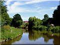
Canal by Brindley Bank in Rugeley, Staffordshire
The Trent and Mersey Canal, looking south-east towards town visitor moorings.
Image: © Roger D Kidd
Taken: 17 Jul 2016
0.11 miles

7
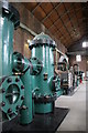
Brindley Bank steam pumping engine
105' long Hathorn, Davey horizontal tandem compound engine operating well pumps and a force pump. Going a bit rusty as the station is no longer used. There are a pair of broadly similar later engines preserved at Mill Meece Pumping Station.
Image: © Chris Allen
Taken: 23 Jun 2007
0.11 miles
8

Trent and Mersey Canal at Brindley Bank, Rugeley
Having just crossed the River Trent on an aqueduct, the canal takes a right angled turn to the left (south-east) at Brindley Bank, north of Rugeley in Staffordshire.
Image: © Roger Kidd
Taken: 18 May 2019
0.11 miles
9

Trent and Mersey Canal at Brindley Bank, Rugeley
Having just crossed the River Trent on an aqueduct, the canal takes a right angled turn to the left (south-east) at Brindley Bank, north of Rugeley in Staffordshire.
Image: © Roger Kidd
Taken: 18 May 2019
0.11 miles
10

Trent & Mersey Canal, Brindley Bank
When James Brindley designed the Trent & Mersey Canal in the 1760s he faced a problem here in what are now the outskirts of Rugeley. With the techniques available at the time he could not build a skewed aqueduct over the River Trent but this meant the route of the canal ran straight into a high bank, necessitating a tight right angled turn that boaters need to navigate with care to this day. Houses have since been built high on the bank with very steep back gardens leading down to the water,
Image: © Stephen McKay
Taken: 26 Jun 2022
0.11 miles