
IMAGES TAKEN NEAR TO
Peregrine Close, LICHFIELD, WS14 9WA
Introduction
This page details the photographs taken nearby to Peregrine Close, WS14 9WA by members of the Geograph project.
The Geograph project started in 2005 with the aim of publishing, organising and preserving representative images for every square kilometre of Great Britain, Ireland and the Isle of Man.

There are currently over 7.5m images from over14,400 individuals and you can help contribute to the project by visiting https://www.geograph.org.uk
Image Map
Images are licensed for reuse under creativecommons.org/licenses/by-sa/2.0
Notes
- Clicking on the map will re-center to the selected point.
- The higher the marker number, the further away the image location is from the centre of the postcode.
Image Listing (63 Images Found)
Images are licensed for reuse under creativecommons.org/licenses/by-sa/2.0
Image
Details
Distance

3

Boundary Stone, Coventry Canal
Actually at the boundary of the Coventry and Birmingham & Fazeley Canals (1790 version see Wiki explanation https://en.wikipedia.org/wiki/Coventry_Canal#History )
The memorial plaque describing the 1990 unveiling is Image
A context view with the fence behind can be seen on the right of Image
Inscription: Birmingham / and / Fazeley / Canal / arrow // Coventry / Canal / arrow
Milestone Society National ID: ST_WHITT01em
Image: © Billy Hufton
Taken: 4 Jun 2024
0.07 miles
4

Memorial Plaque, Coventry Canal
Actually at the boundary of the Coventry and Birmingham & Fazeley Canals (1790 version, see Wiki https://en.wikipedia.org/wiki/Coventry_Canal#History )
It sits below a modern boundary stone at the junction Image
Inscription:
This plaque and boundary stone,
sponsored by
the Lichfield Branch of the
Inland Waterways Association
and unveiled at the bi-centenary
on 22nd July 1990
by Roger Herrington
of British Waterways, marks the
joining of the Birmingham and Fazeley and the Coventry Canals
at Whittington Brook in
July 1790
Image: © Billy Hufton
Taken: 4 Jun 2024
0.07 miles
5

Narrowboat near Whittington in Staffordshire
North of Whittington Bridge.
A short distance ahead the canal transforms from the Birmingham and Fazeley Canal to the Coventry Canal. The village is off to the left.
Image: © Roger Kidd
Taken: 19 Jun 2010
0.08 miles
6
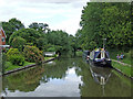
Birmingham and Fazeley Canal at Whittington in Staffordshire
North of Whittington Bridge.
A short distance ahead the canal transforms from the Birmingham and Fazeley Canal to the Coventry Canal. The village is off to the left.
Image: © Roger Kidd
Taken: 19 Jun 2010
0.09 miles

8

Canalside housing in Whittington, Staffordshire
The rhododendron shrub was a brilliant colour even in the prevailing dull conditions. The housing by the Coventry Canal is in Merlin Way.
Image: © Roger Kidd
Taken: 20 May 2019
0.09 miles
9
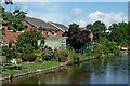
Canalside gardens near Whittington in Staffordshire
This is the Birmingham and Fazeley Canal looking north north of Whittington Bridge. Just past the row of houses, the canal changes to the Coventry Canal for the rest of its course to Fradley Junction.
Image: © Roger Kidd
Taken: 31 Aug 2012
0.09 miles
10

Birmingham and Fazeley Canal near Whittington in Staffordshire
This is the canal looking north from near Whittington Bridge. Close by the end of the row of houses, the canal changes to the Coventry Canal for the rest of its course to Fradley Junction.
Image: © Roger Kidd
Taken: 31 Aug 2012
0.10 miles