
IMAGES TAKEN NEAR TO
Derby Road, LICHFIELD, WS14 9TB
Introduction
This page details the photographs taken nearby to Derby Road, WS14 9TB by members of the Geograph project.
The Geograph project started in 2005 with the aim of publishing, organising and preserving representative images for every square kilometre of Great Britain, Ireland and the Isle of Man.

There are currently over 7.5m images from over14,400 individuals and you can help contribute to the project by visiting https://www.geograph.org.uk
Image Map
Images are licensed for reuse under creativecommons.org/licenses/by-sa/2.0
Notes
- Clicking on the map will re-center to the selected point.
- The higher the marker number, the further away the image location is from the centre of the postcode.
Image Listing (5 Images Found)
Images are licensed for reuse under creativecommons.org/licenses/by-sa/2.0
Image
Details
Distance
1

Rear Entrance to Whittington Barracks
The road on the right goes to the barracks, the road on the left is Common lane and leads to the A51.
Image: © Mick Malpass
Taken: 2 Jul 2011
0.16 miles
2

Post Office outside Whittington Barracks
Image: © Sandy Gerrard
Taken: 10 Jul 2008
0.19 miles
3
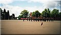
Passing out parade - Whittington Barracks 2001
These young men and women were passing out on their Phase 1 Common Military Training (i.e. becoming soldiers).
Our godson was present prior to going to the RAMC.
In 2007 Whittington Barracks became the Regimental Headquarters of the newly formed Mercian Regiment and has since been transformed following the centralisation of all planning and training of the Defence Medical Services.
Image: © Richard Hoare
Taken: 31 May 2001
0.20 miles
4

Rifle Ranges, Whittington Heath
These ranges are used by the Soldiers at Whittington Barracks.
Image: © Mick Malpass
Taken: 2 Jul 2011
0.21 miles
