
IMAGES TAKEN NEAR TO
Trenance Close, LICHFIELD, WS14 9SJ
Introduction
This page details the photographs taken nearby to Trenance Close, WS14 9SJ by members of the Geograph project.
The Geograph project started in 2005 with the aim of publishing, organising and preserving representative images for every square kilometre of Great Britain, Ireland and the Isle of Man.

There are currently over 7.5m images from over14,400 individuals and you can help contribute to the project by visiting https://www.geograph.org.uk
Image Map
Images are licensed for reuse under creativecommons.org/licenses/by-sa/2.0
Notes
- Clicking on the map will re-center to the selected point.
- The higher the marker number, the further away the image location is from the centre of the postcode.
Image Listing (3 Images Found)
Images are licensed for reuse under creativecommons.org/licenses/by-sa/2.0
Image
Details
Distance
1
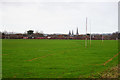
Playing field on Borrowcop Hill
Part of the grounds of King Edward VI School, in sight of Lichfield Cathedral.
Image: © Bill Boaden
Taken: 29 Dec 2017
0.17 miles
2
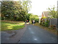
Running out onto Boley Cottage Lane
A narrow footpath joins Boley Cottage Lane from Broad Lane a little way to the west. The runners are participants in the annual 'Cathedral to Castle' 10-mile race which is organised by the local Rotary club; the September 2021 iteration was actually a Covid-19 postponed event from April 2020.
Image: © Richard Law
Taken: 26 Sep 2021
0.18 miles
3
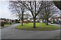
Green on Hillside
Part of a housing estate on the top of Borrowcop Hill.
Image: © Bill Boaden
Taken: 29 Dec 2017
0.23 miles