
IMAGES TAKEN NEAR TO
The Beeches, Neal Croft, LICHFIELD, WS14 9GZ
Introduction
This page details the photographs taken nearby to The Beeches, Neal Croft, WS14 9GZ by members of the Geograph project.
The Geograph project started in 2005 with the aim of publishing, organising and preserving representative images for every square kilometre of Great Britain, Ireland and the Isle of Man.

There are currently over 7.5m images from over14,400 individuals and you can help contribute to the project by visiting https://www.geograph.org.uk
Image Map
Images are licensed for reuse under creativecommons.org/licenses/by-sa/2.0
Notes
- Clicking on the map will re-center to the selected point.
- The higher the marker number, the further away the image location is from the centre of the postcode.
Image Listing (74 Images Found)
Images are licensed for reuse under creativecommons.org/licenses/by-sa/2.0
Image
Details
Distance
1

The Old Swan Inn Cottages, Public House till 1911 when new pub was built.
The 5 smaller cottages were formerly the Swan Inn, a brick arch can still be seen in the front wall where horses were led through to stabling.
Image: © Philip Wood
Taken: 19 Jan 2005
0.07 miles
2
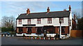
The Swan Hotel Built 1911 Whittington, nr Lichfield.
A very nice canalside pub serving good meals at reasonable prices. Perfect for a sunny day with the kids.
Update: the pub was demolished circa 2012.
Image: © Philip Wood
Taken: 19 Jan 2005
0.08 miles
3
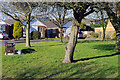
Middleton Road, Whittington
The bungalows on Whittington Road bask in the surprisingly warm February sunshine. The feel of spring being on its way is enhanced by the crocuses on the small green.
Image: © Stephen McKay
Taken: 20 Feb 2023
0.12 miles
4

Housing in Burton Road, Whittington, Staffordshire
This housing in Burton Road, Whittington, is south-east of the canal bridge.
Image: © Roger D Kidd
Taken: 17 Aug 2013
0.13 miles
5

Narrowboats
Several narrowboats on the Coventry Canal at Whittington.
Image: © John Poyser
Taken: 10 May 2007
0.14 miles
6

Bridge No 80, Coventry Canal at Whittington, Staffordshire
Half a mile ahead the canal transforms into the Birmingham and Fazeley Canal with un-numbered bridges, then back to the Coventry Canal (left turn) at Fazeley Junction.
The first section of the canal from Coventry was built 1769-1771 as far as Atherstone. Then the money ran out and the company had to dispense with James Brindley's services. Later, the route was continued to Fazeley, completing that section by 1790 at this junction, the last bridge being No 77. However, because of the delay, the Birmingham to Fazeley Canal had been built, and extended along the planned Coventry Canal route as far as Whittington Brook. This section has no bridge numbers. Beyond Whittington Brook, the Grand Trunk Canal finished off the Coventry Canal's planned route to Fradley and the Trent and Mersey Canal. Later, the Coventry Canal Company bought this last section back, and carried on numbering the bridges with No 78 near Whittington up to 91 near Fradley.
Image: © Roger D Kidd
Taken: 11 Jun 2008
0.14 miles
7

Whittington Bridge No 79
Crossing the Coventry Canal in the village of Whittington.
Image: © Mat Fascione
Taken: 10 Oct 2015
0.14 miles
8
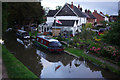
Coventry Canal, Whittington
Looking down from bridge 80.
Image: © Stephen McKay
Taken: 19 Oct 2016
0.14 miles
9

Coventry Canal at Passes Bridge near Whittington
Looking west as the canal meanders towards Fradley Junction.
Passes Bridge is No 79 across the Coventry Canal near the village of Whittington. It carries the unsurfaced Norington Lane.
Image]
Image: © Roger Kidd
Taken: 31 Aug 2012
0.14 miles
10

Coventry Canal at Passes Bridge in Whittington, Staffordshire
This is the Coventry Canal, looking west through the arch of Bridge No 79 across the Coventry Canal close to Whittington. It carries Norington Lane, which is no more than an unsurfaced track.
Image: © Roger Kidd
Taken: 19 Jun 2010
0.14 miles